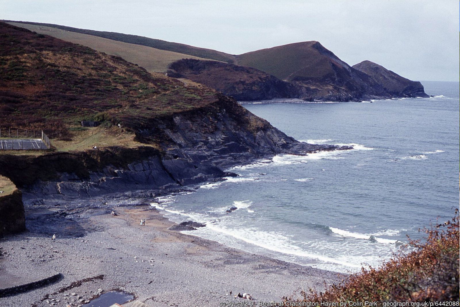
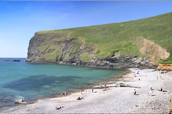
Folded cliffs, waterfalls tumbling to the sea and some of the highest cliffs in Cornwall – two short but rewarding loops from a sheltered cove.
Crackington Haven is a geologist's paradise. Its sandstone and shale cliffs have been folded by great earth movements into dramatic arches (anticlines) and troughs (synclines), and erosion is still very active – rocks fall from overhanging cliffs, and streams carry sand and mud out to sea.
These two loops can be walked separately or together. Loop 1 heads south over the headland of Cambeak towards The Strangles and returns through a wooded valley; Loop 2 climbs north to Pencarrow Point and the little church of St Gennys.
Walk at a glance
- Distance
- Loop 1: 3½ miles (about 1 hr 45 mins)
Loop 2: 2½ miles (about 1 hr 15 mins) - Grade
- Loop 1 moderate, Loop 2 easy – some steep, undulating coast path
- Map
- OS Explorer 111 – Bude, Boscastle & Tintagel
- Start
- Crackington Haven, by the bridge
- Terrain
- Coast path, quiet lanes, fields and a wooded valley
Parking
Car park by the bridge at Crackington Haven, and a second car park just inland from the pub. Spaces fill quickly on sunny summer days.
Facilities
Toilets, a café and the Coombe Barton Inn at Crackington Haven.
Disabled access
Neither loop is suitable for wheelchairs or limited mobility: the National Trust describes the paths as mostly uneven natural surfaces with slopes, steps, stiles and unfenced clifftop, and the coast path dips steeply into several stream valleys. The car park, café, pub and beach are close together at the Haven, so the cove and its folded cliffs can be enjoyed with very little walking.
The route
Loop 1 – Cambeak
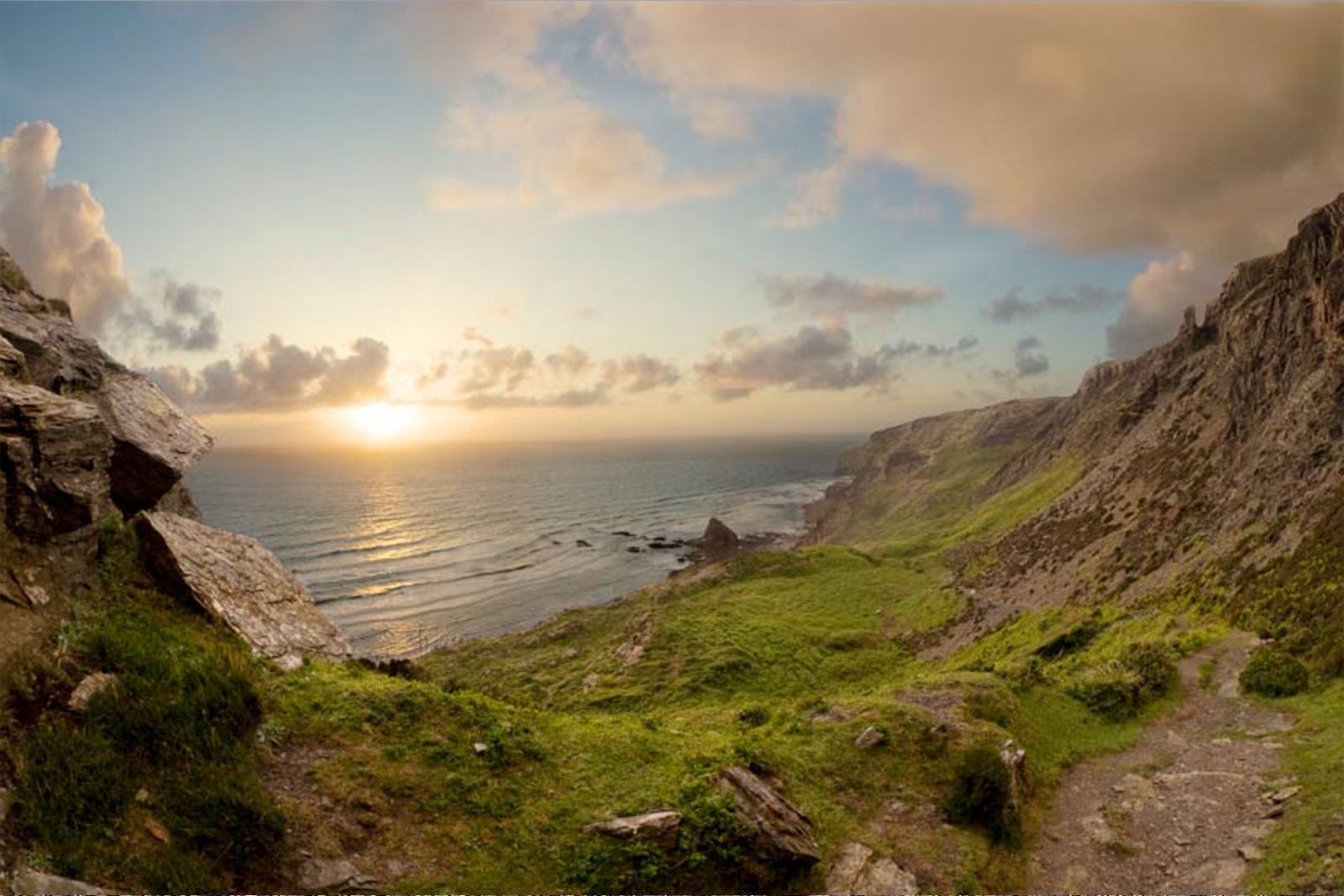
From the bridge, face the sea and follow the coast path to your left. The route is undulating, following the cliff top but dipping to waterfalls where streams cascade into the sea. Soon the path divides – a short detour leads up Cambeak, a dramatic headland with fine views.
Towards The Strangles
Head along the coast path towards the distant beaches. Just before a line of inland cliffs, look out for a left-hand path that leads to the car park for The Strangles and the road. (Going straight on would bring you to the track down to The Strangles beach.)
Trevigue and the wooded valley
At the road turn left and carry on past the farm and holiday accommodation at Trevigue. After a few hundred metres, opposite Woodgate Farm and next to a few houses, take the signed footpath into a wooded valley. At the bottom turn left towards the Haven and continue beside the river – the valley floor was reshaped by the floods of August 2004.
Back to the Haven
Cross a footbridge and turn left at a junction of paths. Cross a second footbridge, go through a gate and follow a track back to the main road, turning left back to Crackington Haven and a well-earned café stop.
Loop 2 – Pencarrow Point
With the inn on your right, follow the road back up the valley for a short distance. Look out on your left for the coast path signed to St Gennys church. The path rises fairly gently to the headland of Pencarrow Point – well worth the climb for the views along the North Cornwall coast.
St Gennys church and Lovers Lane
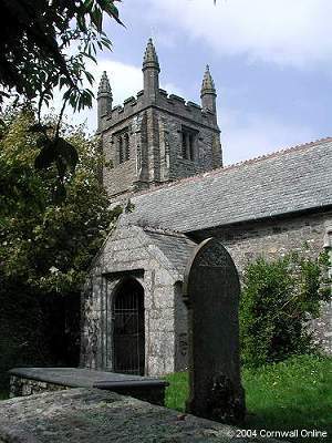
From the coast path head inland through a kissing gate and a gate, following signs to St Gennys church. Follow a field boundary on your left and the church soon appears, tucked into the tiny settlement overlooking the sea. With your back to the church gates turn left along the lane, then first right down a steep lane to the main road. Cross over and continue down the lane; before the valley bottom take the footpath on the right signed to Crackington Haven – Lovers Lane, a leafy track that leads back to the main road.
All information is given in good faith and for guidance only. Always carry the OS map and check the South West Coast Path website for diversions.
Highlights along the way
Folded cliffs
Contorted layers of sandstone and shale make Crackington one of the best places in Britain to see rock folding.
Cambeak
A narrow, dramatic headland just south of the Haven with views along the coast.
The Strangles
A remote beach beneath some of the highest cliffs in Cornwall – reached by a steep path.
St Gennys church
A small, ancient church in a hamlet overlooking the sea.
Nearby
Places to visit
Towns & villages
Photos
Where the walk starts
The marker shows the start of the walk.
Before you set out
Carry the OS map – paths and signs can change and mobile signal is patchy.
Check the weather and tide times before you set out.
Keep to the path and well back from cliff edges.
Keep dogs under close control near livestock and cliffs.