Crackington Haven
A Seaside Award Beach Beneath 400-Foot Cliffs
Crackington Haven, Cornwall, EX23 0JG Seaside Award 2026
Crackington Haven sits within a designated Heritage Coast a few miles south west of Bude, one of the most dramatically scenic beaches in north Cornwall, set beneath cliffs that rise to 400 feet on either side of the bay. It holds Seaside Award status for 2026, and the small village behind the beach has a genuinely welcoming, unhurried feel that makes it a favourite with walkers as much as beach-goers.
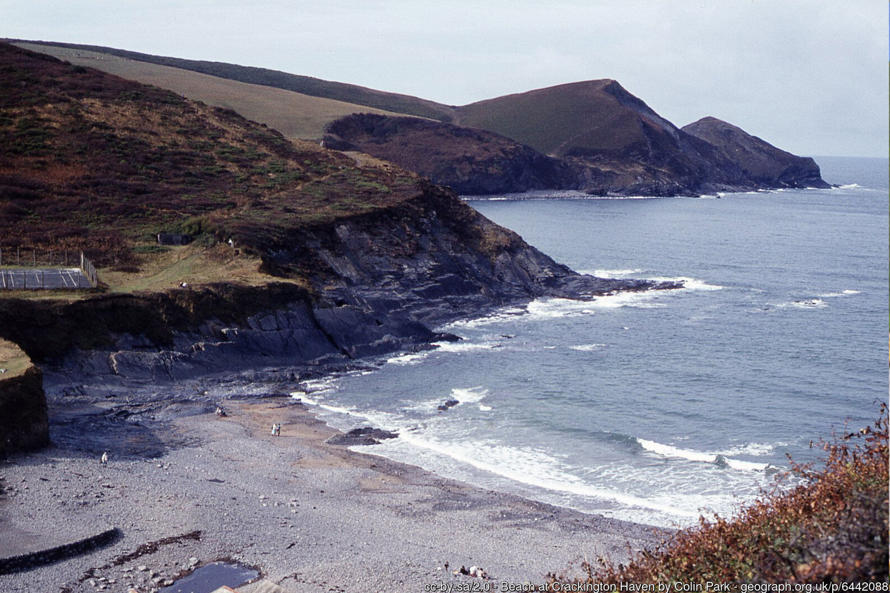
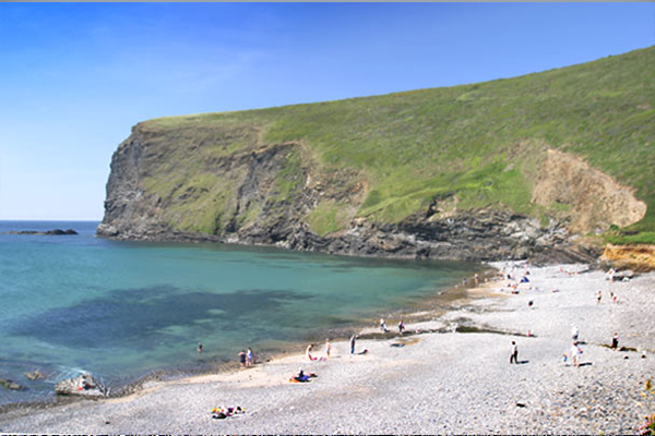
The beach itself is mainly pebbles at high tide, with a good expanse of sand exposed as the tide falls, so timing a visit around low to mid tide makes the most of it. The village directly behind the beach punches well above its weight for facilities: two cafes, a shop, a pub and a surf hire outlet are all within easy reach of the sand, making it an easy full day out even without driving elsewhere for lunch.
RNLI lifeguards provide seasonal cover through the main summer holiday period - check the current dates locally as they can vary slightly year to year. Dogs are subject to the same seasonal restriction as most beaches in the area, typically banned between 10am and 6pm from 15 May to 30 September. Crackington Haven is also the start of a well-known stretch of the South West Coast Path heading towards Boscastle and Tintagel, a route regularly recommended as a multi-day base for exploring this part of the Heritage Coast on foot.
Geologically, Crackington Haven is a place of real significance: the contorted, sharply folded rock beds exposed in the cliffs either side of the cove gave their name to the Crackington Formation, the sequence of Upper Carboniferous sandstones and dark shales that underlies much of this stretch of the Heritage Coast. Laid down as marine sediment roughly 310 million years ago and later crumpled by the same mountain-building episode that shaped much of southwest Britain's coastline, the strata here are folded, faulted and steeply tilted in ways that draw geology students and researchers from well beyond Cornwall.
The beach and its cliffs sit within a Site of Special Scientific Interest for this reason, and fossils - including goniatites, an extinct relative of the ammonite, and small marine bivalves - can be found embedded in the rock on both sides of the cove. A Coastal Protection Order means no rock, fossil or beach material may be removed, so anything found should be photographed and left in place. A few miles north along the coast, the cliffs at Millook show the same Crackington Formation folded into a spectacular, almost accordion-like pattern of chevron folds, one of the most photographed geological features on the entire Cornish coast.
The village has a working history that belies its quiet, holiday-cottage character today. Crackington was recorded as a small manor in the Domesday Book of 1086, and it grew into a modest coastal port during the 19th century, when small vessels used the natural haven to land limestone and coal for the surrounding farms and lime kilns, then load Cornish slate quarried from the local cliffs for the return journey, timing their arrival and departure around the tide. Traces of this era survive in low quay remains and field names around the cove, though nothing on the scale of a working harbour survives today. An ambitious 1836 scheme to build a full harbour and breakwater here, with a proposed railway running inland to Launceston and a new town to be called Victoria, was never carried through - one of several grand Victorian coastal development plans along this coast that came to nothing, leaving Crackington Haven the small, unspoilt hamlet it remains.
The rocky, exposed coast either side of the cove has claimed a number of ships over the centuries, and salvaged wreck timber is said to have supplied some of the building material used in the village's older cottages. The most visible reminder lies a short walk south at Tremoutha Haven, where the wreck of a German E-boat that broke loose and ran aground in October 1946 still lies partly buried in the sand, with sections of its engine occasionally exposed at low tide. More recently, Crackington Haven was badly affected by flash flooding in August 2004, when a sudden, intense downpour sent a torrent down the valley, damaging the road bridge, the pub and several homes - a reminder of how quickly this steep-sided valley can channel heavy rainfall towards the sea, and part of the same storm system that caused the much more widely reported flooding at Boscastle a few miles south on the same day.
Literary visitors sometimes come to this stretch of coast in search of Thomas Hardy, and the connection is real, if slightly indirect to Crackington Haven itself. In March 1870, the young Hardy - then working as an architect - travelled to St Juliot church, a few miles south near Boscastle, to survey it ahead of restoration, and there met Emma Gifford, who later became his wife. The coast path heading south from Crackington Haven towards Boscastle passes close to Beeny Cliff, the dramatic headland Hardy later celebrated in verse after Emma's death, recalling their courtship walks along this same clifftop path. Walkers tackling this section today are following much the same ground that inspired some of Hardy's best-loved poetry, even though the church and rectory where the romance itself began lie a little further along the coast.
Just over a mile south of the beach, the coast path climbs to High Cliff, which at around 735 feet (224 metres) above sea level is the highest cliff on the whole of the Cornish coastline - taller even than the famous cliffs at Land's End. On a clear day the views stretch along the Heritage Coast in both directions. The path continues over Cambeak, a narrow and dramatic headland, before dropping to The Strangles, a remote National Trust beach of golden sand, striped pebbles and a natural rock arch, accessible only on foot and best explored around low tide. This section is a highlight of the wider Crackington to Boscastle walk and is often combined into a longer circular route back through the wooded Ludon Valley.
Much of the coastline and farmland around Crackington Haven, including Trevigue, a 16th-century farmstead above The Strangles, is owned by the National Trust and let to tenant farmers who manage the clifftops with wildlife in mind. Soay sheep, an ancient and hardy breed, graze the thinner cliff soils to keep scrub in check and let wildflowers such as kidney vetch, bird's-foot trefoil, tormentil and thrift flourish through spring and summer, giving way to gorse and heather later in the year. The clifftops attract butterflies including common blue, clouded yellow and small copper, along with kestrels and buzzards hunting the thermals, and breeding stonechats, linnets and warblers in the scrub. Out at sea, grey seals are regularly seen around the rocks either side of the cove, and dolphins and even basking sharks are occasionally spotted offshore in summer.
Crackington Haven also has a modest but genuine surfing reputation. The beach typically breaks as a right-hand wave over sand, works across most states of the tide, and is generally at its best with a north-westerly swell and a light south-easterly, offshore wind - conditions that arise often enough through autumn and winter to make it a regular, if usually uncrowded, stop for local surfers, with board and wetsuit hire available in the village for anyone wanting to try. It suits a wide range of abilities, from complete beginners in small, gentle swell to more experienced surfers when a bigger groundswell wraps into the bay.
North of the village, the coast path climbs away towards Millook and its chevron-folded cliffs, then on towards Widemouth Bay and Bude, giving walkers a choice of direction whichever way they arrive. Within the cove itself, a small stream crosses the beach on its way to the sea, and the sand it has helped build is at its best an hour or two either side of low water; at high tide, particularly on a big spring tide, the beach narrows to a band of pebbles and the sea can reach close to the sea wall, so it is worth checking tide times before planning a full day on the sand, especially with young children or a picnic in tow.
Visitor Information
Parking
Pay and display car park with easy access to the beach, right in the village.
Facilities
Two cafes, a shop, a pub, toilets and surf hire, all within the village. RNLI lifeguards cover the main summer holiday period.
Disabled Access
Easy, fairly level access from the car park to the beach, though the beach surface is pebbly at higher tides. No dedicated Blue Badge bays are confirmed at the pay and display car park - check locally before you travel.
Things to Do Nearby
- Widemouth Bay, a scenic drive north towards Bude
- Bossiney Cove, further south towards Tintagel
- Crackington Haven Village Guide - more on the village and surrounding area
- Boscastle Village Guide - the picturesque harbour village a few miles south
- South West Coast Path Guide - the Bude to Crackington Haven to Tintagel walking route
Places to Stay
Frequently Asked Questions
Page last updated: 8 September 2026.