Holidays in Camelford, North Cornwall – Market Town, Roughtor & Bodmin Moor

Enfield Park gateway, Camelford
Camelford in North Cornwall
North Cornwall Towns and Villages | Padstow | Wadebridge | The Camel Estuary | Rock | Daymer Bay | Polzeath | Port Isaac | Trebarwith Strand | Tintagel | Bossiney Cove | Rocky Valley | Boscastle | Crackington Haven | Bude | Launceston | Camelford | Altarnum | Bodmin |
On This Page
Camelford at a Glance
Market town on the River Camel and the A39 Atlantic Highway, at the north-west edge of Bodmin Moor, about 10 miles north of Bodmin and 6 miles inland from Tintagel. Georgian Town Hall with its golden camel, Roughtor and Brown Willy close by. Sat-nav: PL32 9TB (Churchfield car park).
HOLIDAYS IN CAMELFORD
Camelford is a small and friendly market town in North Cornwall, standing on the River Camel where the A39 Atlantic Highway crosses it, at the north-western edge of Bodmin Moor. It has long been called the gateway to “Camelot country”, and its streets of slate-hung houses, old coaching inns and the handsome Georgian Town Hall, crowned by a golden camel, have seen travellers pass through for centuries.
The town is in a quieter corner of Cornwall, away from the busiest resorts but within easy reach of some of the county’s finest scenery. To the east rise the granite tors of Bodmin Moor, including Roughtor and Brown Willy, the two highest points in Cornwall; to the west, about six miles away, is the spectacular North Cornwall coast at Tintagel, Boscastle and Trebarwith Strand.
Camelford received its charter in 1259 and was for centuries a busy staging post on the old road across North Cornwall. From 1547 until 1832 it returned two Members of Parliament – one of the most notorious “rotten boroughs” in England – and the patronage of its MPs paid for some of the fine buildings that still line its streets.
Today Camelford is a working town with a strong community, a choice of shops, pubs, cafés and takeaways, Sir James Smith’s School, a library in the Town Hall, and the riverside Enfield Park, home to summer evening concerts on the bandstand.
It makes an ideal base for a walking, touring or family holiday. Walkers have the moor on the doorstep, families can reach the beaches of the north coast in minutes, and history lovers can explore King Arthur’s Stone at Slaughterbridge, Tintagel Castle and the churches and villages of the moor. Holiday cottages, farmhouses and B&Bs are scattered across the surrounding countryside.
This guide covers everything you need for a holiday in Camelford: the town and its history, the Camelot legends and King Arthur’s Stone, Roughtor and Bodmin Moor, the River Camel, things to do, walks, places nearby and local events, plus practical visitor information on parking, buses, shops and health services.
↑ Back to topTHE TOWN
The heart of Camelford is Fore Street, the main street of the town, which climbs from the bridge over the River Camel past shops, pubs and old coaching inns. Running parallel to it is Chapel Street, once known as Back Street, with cobbled gullies down each side and little slate bridges to the cottage doors. Narrow alleyways, known locally as “opes”, link the two.
The Town Hall was built in 1806 for the Duke of Bedford, the lord of the manor, replacing an earlier market house. It began as a market house and assembly room and later housed the petty sessions and county court; today it is the town library and a community hub. Its timber cupola is topped by the famous golden camel weathervane – a play on the town’s name, which actually has nothing to do with camels. The clock was installed by John Thwaites of Clerkenwell, and by the entrance hangs an old market bell given by the mayor, William Prideaux, in 1699.
By the river, Enfield Park was given to the town in 1922 by Albert Tingcombe, a Camelford tailor who had worked for most of his life in Enfield. It is the setting for the summer “Friday Nights on the Bandstand” concerts and the town market.
Across the bridge stands Camelford House, whose most famous owner was Thomas Pitt, 2nd Baron Camelford (1775–1804), a cousin of the Prime Minister William Pitt the Younger. His short and turbulent life included service in the Navy, a court martial and, finally, death in a duel at the age of 29.
Camelford’s own church, St Thomas of Canterbury, by Churchfield car park, was opened in 1938, but the ancient parish church is St Julitta’s at Lanteglos, about a mile and a half from the town in a peaceful wooded valley. The town’s Methodist chapel in Chapel Street recalls John Wesley, who preached in Camelford many times from the 1740s.
↑ Back to top
The Golden Camel
The gilded camel on the Town Hall cupola is Camelford’s best-known symbol – a pun on the town’s name, which actually comes from the River Camel and the old ford across it.
HISTORY OF CAMELFORD
Camelford grew up at a crossing of the River Camel, and its name means simply “the ford over the Camel”. It is first recorded in the early 13th century, and in 1259 Richard, Earl of Cornwall, brother of Henry III, granted the town its charter, creating the borough. A later charter of Charles II, in 1669, incorporated it.
Because Bodmin Moor was so difficult to cross, the main roads skirted around it, and Camelford became an important stopping place on the northern route through Cornwall. Its inns flourished, and in the 18th century turnpike trusts improved the roads and set up toll-gates on the approaches to the town. Granite milestones from this era can still be seen along the old roads.
From 1547 Camelford returned two Members of Parliament. With only a handful of voters, it became a classic rotten borough, controlled by wealthy patrons, until the Reform Act of 1832 abolished the seat. The money spent by its patrons and MPs helped build some of the town’s finer houses, including the Town Hall.
The railway reached Camelford in 1893, when the North Cornwall line opened a station about a mile and a half north of the town. It brought visitors to the coast at Tintagel and Boscastle, but the line closed in 1966. In July 1988 the town was affected by a serious water contamination incident, when aluminium sulphate was accidentally added to the wrong tank at the Lowermoor water treatment works.
Today Camelford is the main town for a wide rural area of North Cornwall, with Sir James Smith’s School, named after the 17th-century MP who endowed a school here, serving the town and surrounding villages.
↑ Back to top
CAMELOT & KING ARTHUR’S STONE
For centuries Camelford has been linked with the legends of King Arthur. Some writers claimed it was Camelot itself, and that Arthur fought his last battle, against Mordred at Camlann, at Slaughterbridge, just over a mile north-west of the town. Modern historians regard these stories as legend, and the name Slaughterbridge is thought to come from an Old English word for marshy ground rather than from any battle.
Beside the River Camel at Slaughterbridge lies an ancient inscribed stone known as King Arthur’s Stone. First recorded by the Cornish historian Richard Carew in 1602, it actually dates from the 6th century and carries both Latin and Ogham inscriptions. The Latin reads Latini [h]ic iacit fili Macari – “Latinus, son of Macarus, lies here” – commemorating an otherwise unknown local chieftain.
The stone lies within the Vale of Avalon and Arthurian Centre at Slaughterbridge, which has an exhibition, a woodland and riverside walk, an 18th-century garden, a children’s play area and a tearoom. Check opening times before you visit.
Whatever the truth of the legends, the landscape around Camelford is rich in Arthurian associations: Tintagel Castle, where Geoffrey of Monmouth placed Arthur’s conception, is only six miles away, and Dozmary Pool on Bodmin Moor is said to be where the sword Excalibur was returned to the Lady of the Lake.
↑ Back to top
MAP OF CAMELFORD
ROUGHTOR & BODMIN MOOR
Rising above the moor about three miles south-east of Camelford, Roughtor (pronounced “row-tor”) is one of the most dramatic places in Cornwall. At 400 metres (1,313 feet) it is the second-highest point in the county, crowned by great stacks of weathered granite. Its summit was given to the nation in memory of the men of the 43rd (Wessex) Division who died in 1944–45, and it is cared for by the National Trust.
The tor is rich in history. Stone walls on the summit may mark a Neolithic tor enclosure, a medieval chapel of St Michael once stood on the top, and the southern slopes are covered with the remains of Bronze Age hut circles and field systems. Near the path from the car park is the memorial to Charlotte Dymond, a young servant girl murdered here in 1844.
From Roughtor you can see across the moor to Brown Willy, about a mile to the south-east, which at around 420 metres is the highest point in Cornwall. A walk taking in both tors is one of the classic routes on Bodmin Moor.
The Roughtor car park, reached along Roughtor Road from Camelford, is about a mile and a half’s walk from the summit. The ground is rough and can be boggy, and the weather can change quickly, so wear boots and take waterproofs. On winter evenings, starling murmurations can sometimes be seen over the plantations near the car park.
↑ Back to top

THE RIVER CAMEL
The River Camel rises on the moor above Camelford and flows through the town on its way south past Wadebridge to the sea at Padstow. Around Camelford it is a small, fast-flowing moorland river, and the riverside path known as the Camelford Way follows the valley – especially lovely in spring, when bluebells line the banks.
The Camel is known for its salmon and sea trout fishing, and further downstream the old railway line from Wenfordbridge through Wadebridge to Padstow is now the Camel Trail, one of the most popular traffic-free cycle routes in Britain, with cycle hire available along the way.
Downstream from Wadebridge the river widens into the beautiful Camel estuary, with the sandy beaches of Rock, Daymer Bay and Polzeath on one side and Padstow on the other.
↑ Back to top
THINGS TO DO IN CAMELFORD
Camelford is a great base for exploring both the moor and the coast. Within a few miles you can climb Cornwall’s highest tors, visit Tintagel Castle, swim at Trebarwith Strand or cycle the Camel Trail.
Here are some of the best things to do in and around Camelford:
- Climb Roughtor – the second-highest point in Cornwall, with Bronze Age remains.
- Walk to Brown Willy – the highest point in Cornwall, from the Roughtor car park.
- See King Arthur’s Stone – the 6th-century inscribed stone at Slaughterbridge.
- Admire the golden camel – on top of the 1806 Town Hall.
- Visit Lanteglos church – the old parish church of St Julitta in its wooded valley.
- Explore Tintagel – the castle, Merlin’s Cave and the Old Post Office, about six miles away.
- Spend a day at Trebarwith Strand – the nearest big sandy beach, about ten minutes’ drive.
- Cycle the Camel Trail – from Wadebridge to Padstow along the estuary.
- Play golf – at Bowood Park, just outside the town.
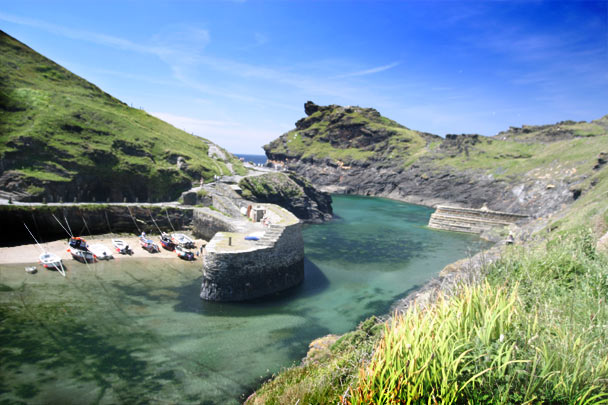
- Visit Boscastle and Port Isaac – two of the prettiest harbours in Cornwall.
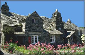
Golf near Camelford
Bowood Park Hotel & Golf Club at Lanteglos, just outside the town, has an 18-hole parkland course. See our Cornwall golf guide for more courses.
WALKS AROUND CAMELFORD
The Camelford Way is a walking route along the valley of the River Camel, through woodland and meadows close to the town. Quiet lanes and footpaths also lead out to Lanteglos church and to Slaughterbridge.
On the moor, the classic walk from the Roughtor car park climbs to the summit of Roughtor and continues across the moor to Brown Willy – about five miles there and back, on rough and sometimes boggy ground. Dogs must be kept on leads on the moor from 1 March to 31 July for ground-nesting birds and lambing.
The South West Coast Path is only a short drive away: the walks from Tintagel to Trebarwith Strand, and from Port Isaac to Port Quin, are among the finest in North Cornwall.
↑ Back to topMore Walks
See our Trebarwith Strand & Tintagel walk, Port Isaac to Port Quin walk and all North Cornwall walks.
AROUND CAMELFORD
- Tintagel – the legendary castle and the Old Post Office, about six miles north-west.
- Boscastle – the National Trust harbour village and the Museum of Witchcraft and Magic.
- Trebarwith Strand – a big sandy surf beach at low tide.
- Port Isaac – the fishing village famous from Doc Martin.
- Delabole – the village of the great slate quarry and Britain’s first commercial wind farm, about three miles west.
- Wadebridge and Bodmin – market towns on the River Camel and the Camel Trail.
Getting Here
Camelford is on the A39 Atlantic Highway between Wadebridge and Bude. From the A30, turn off at Launceston or Bodmin, or take the A395 and A39 from Kennards House. Sat-nav: PL32 9TB.

LOCAL EVENTS
Camelford has a lively community calendar, with summer music in Enfield Park, the town market, the agricultural show and the carnival. Camelford Town Council publishes an events calendar each year.
- Friday Nights on the Bandstand (July) – free summer evening music in Enfield Park.
- Camelford Town Market (summer) – local stalls at the bandstand in Enfield Park.
- Camelford & District Agricultural Show (August) – livestock, horses, crafts, a dog show and a fun fair.
- Camelford Carnival (autumn) – the town’s evening carnival procession.
- Royal Cornwall Show (June) – three days at the Royal Cornwall Showground near Wadebridge.
Dates change from year to year, so check before you travel.
↑ Back to topCheck Before You Go
See the Camelford Town Council events calendar, our Cornwall events guide and the organisers’ own websites for current dates.
VISITOR INFORMATION
Parking & EV Charging
Camelford Town Council runs the two town car parks: Churchfield car park, Victoria Road (PL32 9TB), with a short free period, and Clease Road car park (PL32 9QX). Both are a few minutes’ walk from Fore Street. There is also a car park below Roughtor on the moor.
Electric vehicle charging:
- Churchfield car park, Victoria Road – 2 ultra-rapid chargers (Pogo), PL32 9TB
- Clease car park, Clease Road – slow chargers (Pod Point), PL32 9QX
Bus & Train
Go Cornwall Bus routes include the 95 to Tintagel, Boscastle and Bude, the 96 to Delabole, Port Isaac, Polzeath and Wadebridge, the 97 to Launceston and the 55 to Bodmin. The nearest railway station is Bodmin Parkway, about 14 miles away. Check timetables before you travel.
Facilities & Supermarkets
Shops, pubs, cafés and takeaways on Fore Street and around the town, and a library in the Town Hall. For a bigger weekly shop, the nearest larger supermarkets are in Wadebridge. Supermarkets include:
- Co-op – High Street, Camelford PL32 9PQ
- Aldi – 8 Dunveth Business Park, West Hill, Wadebridge PL27 7FE
- Lidl – Eddystone Road, Wadebridge PL27 7AL
- Tesco Superstore – West Hill, Wadebridge PL27 7HW
Cafés & Restaurants
Pubs and old coaching inns, cafés and takeaways in the town centre, with country pubs in the surrounding villages and the tearoom at the Arthurian Centre at Slaughterbridge. More choice in Tintagel, Boscastle and Port Isaac.
Health
Camelford Medical Centre, Church Field, Camelford PL32 9YT. The nearest Minor Injury Units are at Launceston and Bodmin Community Hospitals – check opening hours before travelling. Call NHS 111 for urgent advice and 999 in an emergency. The nearest major A&E departments are the Royal Cornwall Hospital, Truro, and Derriford Hospital, Plymouth.
Disabled Access
The town centre is compact, but Fore Street and Chapel Street are on a slope and some pavements are narrow. Enfield Park is fairly level. On the moor, paths are rough and uneven. Check Blue Badge parking on the car park signs.
Vets & Dogs
Penbode Vets, Inns Park, Camelford PL32 9RX. Dogs are welcome on the moor, but must be on a lead from 1 March to 31 July for ground-nesting birds and lambing, and near livestock at all times.
National Trust & English Heritage
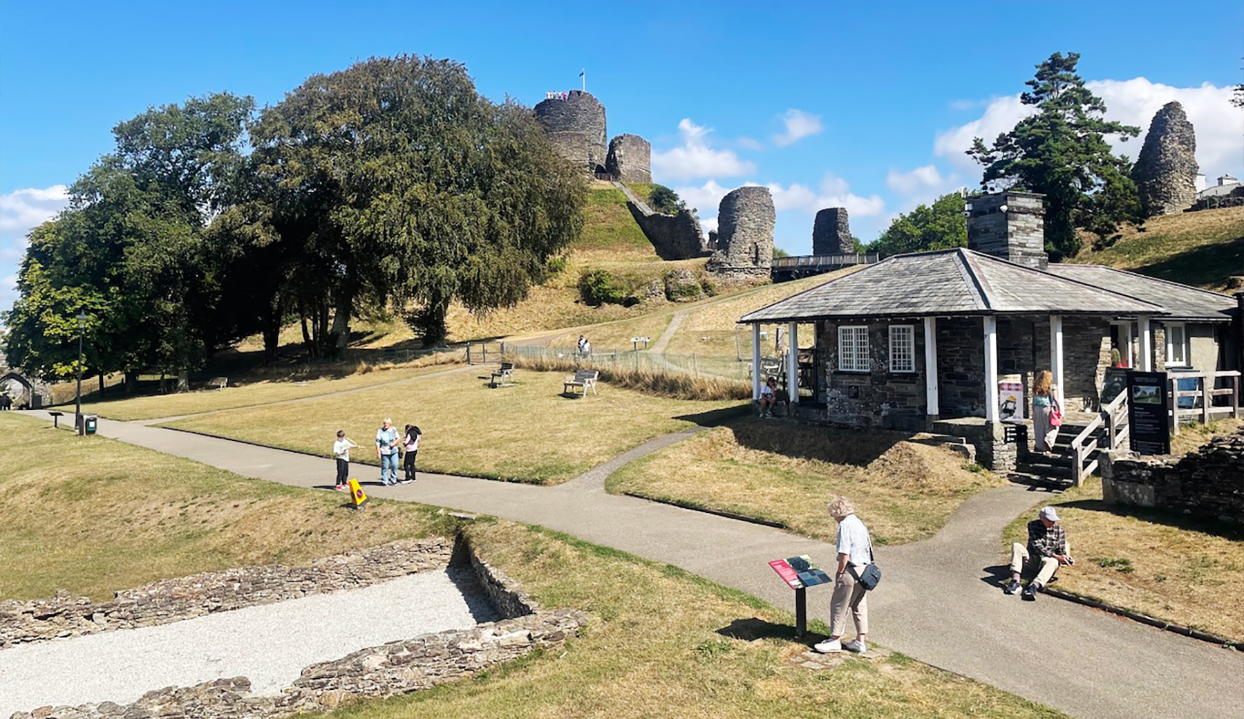
The National Trust cares for Roughtor, the Old Post Office in Tintagel and Boscastle harbour. Tintagel Castle and Launceston Castle are cared for by English Heritage.
Beaches
Camelford is inland, but the north coast is close: Trebarwith Strand (about ten minutes’ drive), Bossiney Haven near Tintagel, Boscastle harbour, and the big sands of Polzeath and Bude a little further.
STAY & EXPLORE NEAR CAMELFORD
Beaches & Surf
Official Information
FAMILY HOLIDAYS & SHORT BREAKS IN CAMELFORD
Family holidays in Camelford combine moor and coast. Children love scrambling on the granite of Roughtor, spotting ponies on the moor, hunting for King Arthur at Slaughterbridge and Tintagel, and building sandcastles at Trebarwith Strand or Polzeath, all within a short drive.
A self-catering holiday in Camelford lets you explore at your own pace: cottages in the town, farmhouses and barn conversions in the countryside around Lanteglos and Davidstow, and lodges on the edge of the moor. Many holiday cottages around Camelford welcome dogs too.
Camelford is also a good choice for a short break or weekend away at any time of year – walking on the moor, touring the north coast, or simply enjoying a quieter corner of Cornwall. Booking direct with the owner means no agency fees.
Browse self-catering holidays in Camelford for holiday cottages and apartments, or holidays and short breaks in Camelford for every type of accommodation – B&Bs, inns, holiday parks, camping and glamping – all listed on Cornwall Online by their owners.
↑ Back to topFREQUENTLY ASKED QUESTIONS ABOUT CAMELFORD
Yes – Camelford is a small, friendly market town on the River Camel at the edge of Bodmin Moor. It makes an excellent base for walking on Roughtor and Brown Willy, and the North Cornwall coast at Tintagel, Boscastle, Trebarwith Strand and Port Isaac is only a short drive away.
Camelford has long been linked in legend with Camelot, and nearby Slaughterbridge with Arthur’s last battle at Camlann, but modern historians regard these claims as legend rather than history. The name Camelford simply means a ford over the River Camel. The inscribed “King Arthur’s Stone” at Slaughterbridge actually commemorates a 6th-century man named Latinus.
Camelford Town Council runs the two town car parks: Churchfield car park on Victoria Road (PL32 9TB), which has ultra-rapid EV chargers, and Clease Road car park (PL32 9QX). Both are a short walk from the shops on Fore Street.
Camelford is about six miles inland. Trebarwith Strand is around a ten-minute drive, and Tintagel, Boscastle, Port Isaac and Polzeath are all within easy reach.
Take Roughtor Road from Camelford to the moorland car park below the tor, about three miles from the town. From the car park it is around a mile and a half’s walk to the summit, which at 400 metres is the second-highest point in Cornwall. Brown Willy, the highest, is about a mile further.
The Camelford and District Agricultural Show is held in August, with livestock, horses, shearing, a handicraft marquee, a dog show and a fun fair. It celebrated its 117th show in 2025. Check the show’s own website for this year’s date and venue.
Yes. Go Cornwall Bus routes include the 95 to Tintagel, Boscastle and Bude, the 96 to Delabole, Port Isaac, Polzeath and Wadebridge, the 97 to Launceston and the 55 to Bodmin. The nearest railway station is Bodmin Parkway, about 14 miles away.
Yes. The riverside Camelford Way follows the River Camel valley, there are lanes and paths to Lanteglos church and Slaughterbridge, and the open moorland of Roughtor and Brown Willy is a short drive away. The coast path between Tintagel and Port Isaac is also close by.
North Cornwall Towns and Villages | Padstow | Wadebridge | The Camel Estuary | Rock | Daymer Bay | Polzeath | Port Isaac | Trebarwith Strand | Tintagel | Bossiney Cove | Rocky Valley | Boscastle | Crackington Haven | Bude | Launceston | Camelford | Altarnum | Bodmin |