Back to West Cornwall & The Lizard walks
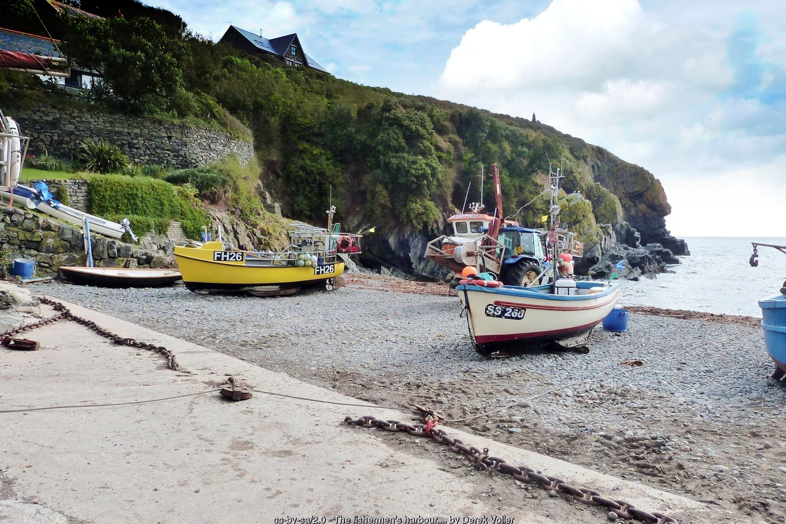
A long, fascinating day on the coast path from the most southerly point of mainland Britain, past fishing coves and serpentine cliffs to Coverack and St Keverne.
This is a linear walk along one of the finest stretches of the South West Coast Path. It starts at Lizard Point, the most southerly point of mainland Britain, and follows the east coast of the Lizard Peninsula past Bass Point, the lifeboat station, Cadgwith and Kennack Sands to Coverack, finishing inland at St Keverne.
Allow a full day and plan your return by bus – routes and times change, so check the current timetables on the Transport for Cornwall website before you set out.
Walk at a glance
- Distance
- About 14 miles, one way (8+ hrs)
- Grade
- Moderate, with a stiff climb up to Beagles Point
- Map
- OS Explorer 103 – The Lizard
- Start
- Lizard Point (finish at St Keverne)
- Terrain
- Coast path, gravel paths and serpentine stiles – very slippery when wet
- Getting back
- Linear walk – check current bus times between St Keverne, Helston and The Lizard before you set out
Parking
Car parks in Lizard village and at Lizard Point (National Trust). As this is a one-way walk, plan your return by bus or arrange a lift.
Facilities
Toilets and cafés at Lizard village and Lizard Point; cafés and pubs at Cadgwith, Kennack Sands (seasonal), Coverack and St Keverne.
Disabled access
This long linear walk is not suitable for wheelchairs or anyone with limited mobility: the coast path has steep climbs, notably up to Beagles Point, steps, and serpentine stiles that are very slippery when wet. At the start, a short sloping gravel and tarmac path from the National Trust car park at Lizard Point avoids steps and is suitable for wheelchairs and pushchairs, giving views of the point. The car park has accessible parking and accessible toilets.
Places to stay
The route
Lizard Point to Bass Point
From Lizard Point follow the coast path east. The well-trodden path passes the old Lloyd’s Signal Station and, close to the path, the Lion’s Den – a huge hole in the cliff top made when a sea cave roof collapsed in 1847. It is well fenced and signed; take great care. Bass Point, with its National Coastwatch lookout, is the next headland.
The lifeboat station and the Devil’s Frying Pan
The path soon reaches the Lizard Lifeboat Station at Kilcobben Cove. Continue up and down a few gentle slopes, past another collapsed sea cave, the Devil’s Frying Pan, and down into Cadgwith – a working fishing cove with its boats drawn up on the shingle.
Poltesco and Kennack Sands
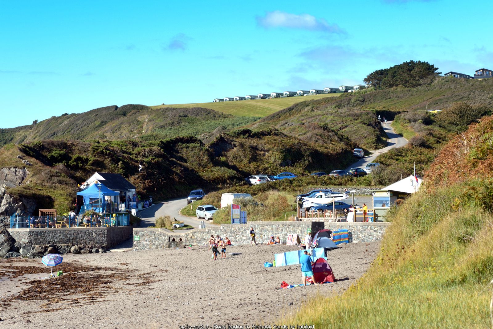
Continue via Enys Head to the National Trust cove at Poltesco, then on to the twin beaches of Kennack Sands. At the far end of the beach a small pond, crossed by a wooden bridge, is alive with dragonflies in summer.
Carrick Luz and Beagles Point
Beyond Kennack an old ship’s boiler lies on the beach at Spernic Cove – a reminder of the dangers of this coast. Carrick Luz has the remains of an Iron Age cliff fort, and old mine workings can be seen around Downas Cove – a good lunch stop before the climb to Beagles Point, the stiffest of the day.
Black Head to Coverack
Rounding Black Head the path turns north and the rock changes from the famous Lizard serpentine – used for stiles and hedges and very slippery when wet. Pass Chynhalls Point, make a short detour inland around a hotel, and you arrive in Coverack, with its harbour, pub and cafés.
The Manacles and St Keverne
Continue past Lowland Point, with the notorious Manacles rocks offshore, and follow the signed coast path past Dean Quarry to Godrevy Cove. From here the route leaves the coast and heads inland to finish in the square at St Keverne, where you can catch the bus back.
All information is given in good faith and for guidance only. Always carry the OS map and check the South West Coast Path website for diversions.
Highlights along the way
Lizard Point
The most southerly point of mainland Britain, with its lighthouse and serpentine workshops.
Cadgwith
A picture-postcard fishing cove where boats are still winched up the beach.
Kennack Sands
Two sandy beaches backed by a nature reserve.
The Manacles
A reef off Coverack responsible for hundreds of shipwrecks.
Nearby
Towns & villages
Photos

Where the walk starts
The marker shows the start of the walk.
Before you set out
Carry the OS map – paths and signs can change and mobile signal is patchy.
Check the weather and tide times before you set out.
Keep to the path and well back from cliff edges.
Keep dogs under close control near livestock and cliffs.