Back to West Cornwall & The Lizard walks
Wild heathland, rare plants and seabirds on Mullion Island – a short circuit on the cliffs south of Mullion Cove.
Mullion Cliff, to the south of the harbour, is part of the Lizard National Nature Reserve. The Cornish heath that grows so abundantly here is found almost nowhere else in Britain and is at its best in late summer.
Ponies and sheep are used to graze the cliffs, keeping coarse grasses, bramble and gorse under control so the rarer plants are not smothered.
Walk at a glance
- Distance
- 3½ miles (allow up to 4 hrs with stops)
- Grade
- Moderate – wet in places, even in summer
- Map
- OS Explorer 103 – The Lizard
- Start
- Mullion Cove
- Terrain
- Coast path, stiles, farm tracks and a quiet road
Parking
Car park above Mullion Cove (not a National Trust car park, so charges apply to everyone), or park in Mullion village and walk down.
Facilities
Pubs, shops and toilets in Mullion; café at Mullion Cove (seasonal).
Disabled access
This walk is not suitable for wheelchairs or anyone with limited mobility: the cliff path has stiles, gates and wet, uneven ground, and the field section crosses stone stiles. The car park above Mullion Cove has a potholed stone surface and no marked disabled bays, and the road down to the harbour is steep. There is a seasonal accessible toilet (RADAR key) beside the road to the cove.
Places to stay
The route
Onto Mullion Cliff
From the harbour, take the coast path on your right as you head up the road out of the cove. Continue along the coast path, over a wooden stile and down into a small valley.
Along the cliffs
Beyond the valley the path is fairly level, though wet in places even in summer. Offshore, Mullion Island is home to a large colony of breeding seabirds. Look out for the grazing ponies and sheep.
Inland to Predannack
Pass through a kissing gate and cross a wooden stile into the valley. Take the first path on the left on the far side of the valley, cross a stone stile and turn left onto a stony track past a group of farm buildings. After these, follow the tarmac road; at the end of the third field on the left is a public footpath.
Back to Mullion Cliff
Follow the footpath through two fields into a lane. Cross the stone stile on the right and the next field before turning right onto the road near Predannack Manor Farm. At the corner turn left onto the track to Mullion Cliff, which brings you back onto the cliffs above Mullion Cove where the walk began.
All information is given in good faith and for guidance only. Always carry the OS map and check the South West Coast Path website for diversions.
Highlights along the way
Mullion Cove
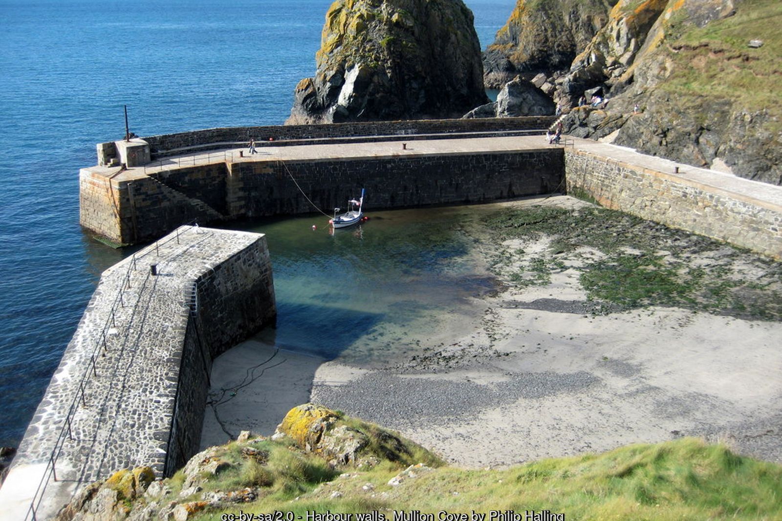
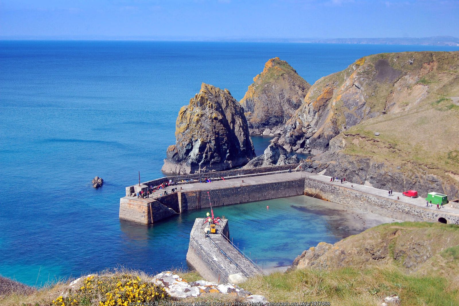
A tiny harbour with a sturdy granite and serpentine breakwater.
Cornish heath
A rare heather that flourishes on the serpentine soils of the Lizard.
Mullion Island
An important seabird colony just offshore.
Predannack
Open, wild cliff land managed for wildlife.
Nearby
Beaches
Places to visit
Towns & villages
Photos
Where the walk starts
The marker shows the start of the walk.
Before you set out
Carry the OS map – paths and signs can change and mobile signal is patchy.
Check the weather and tide times before you set out.
Keep to the path and well back from cliff edges.
Keep dogs under close control near livestock and cliffs.