Back to East Cornwall & Bodmin Moor walks

Panoramic views over Bodmin Moor, stone circles, granite tors and some of the most atmospheric mining remains in Cornwall.
Minions, on the south-eastern edge of Bodmin Moor, is the highest village in Cornwall. This circular walk heads south around Caradon Hill on an old mineral tramway, with panoramic views across the moor, then drops into the Gonamena valley past the ruins of South Caradon mine.
The car park is close to the Hurlers – three Bronze Age stone circles – and is also a good starting point for exploring the Cheesewring, a granite tor to the north of the village.
Walk at a glance
- Distance
- 4 miles (about 2 hrs)
- Grade
- Easy to moderate – rough ground and a steep, rocky descent
- Map
- OS Explorer 109 – Bodmin Moor
- Start
- Minions car park, by the Hurlers
- Terrain
- Old tramways, moorland tracks, open grazing and footpaths – unclear in places
Parking
Free car park at the western edge of Minions, close to the Hurlers stone circles.
Facilities
Public toilets (check they are open), a café, pub and shop in Minions. The Minions Heritage Centre in Houseman’s Engine House has been closed since 2020.
Disabled access
This walk is not suitable for wheelchairs: although the old tramway sections are mostly level, they are rough and stony, and the route crosses open moorland, drops steeply over rocky ground into the Gonamena valley and follows paths that are boggy and unclear in places. From the free car park at the western edge of the village, the Hurlers stone circles are a short walk across level moorland grass, and the broad gravel track of the old railway towards the Cheesewring quarry is fairly firm and level at first, with wide views; the final approach to the Cheesewring is over rocks and boulders. There are public toilets in the village, but check they are open before relying on them.
Places to stay
The route
Minions to the tramway
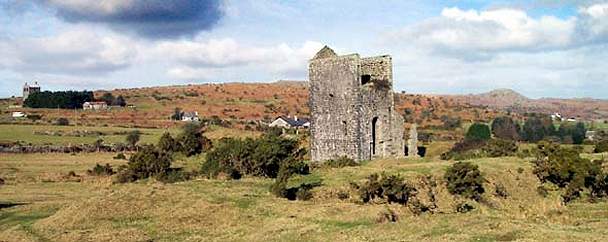
Leave Minions heading towards the Caradon Hill mast on the tarmac track beside the village shop. You need not stay on it for long: to your left are several disused engine houses. Cross the open ground through a gap in the field boundary to the furthest engine house, where you will find a disused tramway – your path around Caradon Hill.
Around Caradon Hill
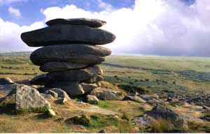
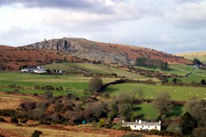
Turn right along the tramway and enjoy the views of Bodmin Moor – the granite tors, the Cheesewring perched above its quarry and Sharp Tor above the village of Henwood. As you walk east, Kit Hill with the mine stack on its summit comes into view, sheltering the old mining town of Callington.
Above Upton Cross
As the tramway sweeps south above the village of Upton Cross (home of Sterts theatre), you pass the edge of a large mound of mine waste. Continue south for about 1 km until the tramway runs close to the road, keeping the spoil heap on your right, until a large building appears on your right.
Up to the old quarry
To the left of the building is a stone wall. Follow it upwards towards the mast, crossing to its left when you can. Look out for Plymouth Sound, Looe Bay and the china clay tips of St Austell in the distance. Near the top, head left towards a large pile of quarried boulders – the old quarry makes a sheltered picnic spot.
Down through South Caradon mine
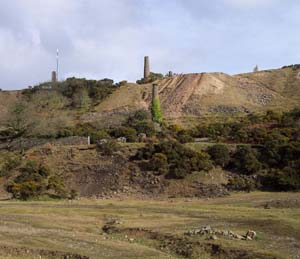
From the mouth of the quarry follow an unmarked path south, away from the mast, and the whole Gonamena valley comes into view. Head south-south-west towards the ruined engine houses and chimneys of South Caradon mine, with the village of St Cleer in the distance. Follow the track down between the engine houses; at the next junction turn right onto a wide rough track down to the valley floor.
Up the Gonamena valley to Minions
The valley floor is cobbled in places where “bal maidens” once broke up ore by hand. Follow the stream – the headwaters of the River Seaton – back towards its source, keeping to the right-hand bank. Make for the old farmhouse of Gonamena and pick up the signed footpath, which is unclear in places; keep straight on, through a cutting and past the remains of a tramway bridge, through a metal gate and back to Minions, passing a marshy area and derelict cottages at the source of the Seaton.
All information is given in good faith and for guidance only. Always carry the OS map and check the South West Coast Path website for diversions.
Highlights along the way
The Hurlers
Three Bronze Age stone circles next to the village (English Heritage).
The Cheesewring
A weathered granite tor above a vast old quarry.
South Caradon mine
Once one of the richest copper mines in Cornwall – part of the Cornish Mining World Heritage Site.
Caradon Hill
Sweeping views from Bodmin Moor to Plymouth Sound and Dartmoor.
Nearby
Towns & villages
Photos
Where the walk starts
The marker shows the start of the walk.
Before you set out
Carry the OS map – paths and signs can change and mobile signal is patchy.
Check the weather and tide times before you set out.
Keep to the path and well back from cliff edges.
Keep dogs under close control near livestock and cliffs.