Back to English Heritage Cornwall
Minions, Liskeard, Cornwall PL14 5LE | 0370 333 1181
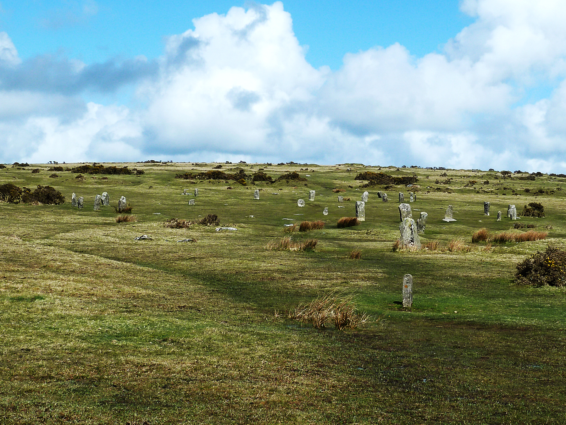
The Hurlers are among Cornwall's most striking prehistoric monuments: three Late Neolithic or Early Bronze Age stone circles set in a line on the open, granite-strewn moorland near the village of Minions. English Heritage describes the grouping of three adjacent circles as unique in England, and their setting, high on the eastern edge of Bodmin Moor within the Cornwall and West Devon Mining Landscape World Heritage Site, makes them one of the most atmospheric places to encounter Cornwall's deep prehistory.
The circles themselves are not identical. The central circle is the most complete, with fourteen surviving original stones; the northern circle retains fifteen; and the southern circle is more fragmentary, with nine stones remaining, several of them fallen. Their exact purpose is unknown, but their careful construction, deliberate spacing and evident relationship to other nearby monuments show they belonged to a wider ceremonial landscape used by Bronze Age communities for gatherings whose meaning has long since been lost to us.
That wider landscape is part of what makes a visit to the Hurlers so rewarding. Within sight or a short walk are The Pipers, two isolated standing stones associated with local legend; Stowe's Pound, a massive prehistoric hilltop enclosure; and Rillaton Barrow, a Bronze Age burial mound famous for the discovery of a gold cup now in the British Museum. Together they form one of the densest concentrations of prehistoric monuments anywhere in the south-west.
The Hurlers are owned by English Heritage but cared for day-to-day by the Cornwall Heritage Trust, and remain free to visit at any reasonable time. There is no visitor centre on site, but the nearby village of Minions, the highest village in Cornwall, has a shop and tea room, making it easy to combine the circles with refreshments and a wider walk across the moor.
Location Map
Visitor Guide
From the free car park at Minions, it is a walk of around a quarter of a mile across uneven, open moorland to reach the circles. The ground can be wet and boggy, particularly after rain, so sturdy footwear is essential whatever the season. The site is remote and very exposed, with no shelter of any kind, so it is worth checking the weather before setting out.
The three circles reward a slow walk between them. Looking closely, visitors can pick out the surviving original stones alongside modern markers showing where missing stones once stood, evidence of the careful excavation and partial restoration carried out in the 1930s. A little further west, the two standing stones known as The Pipers add to the sense of a deliberately organised, wider prehistoric landscape rather than a single isolated monument.
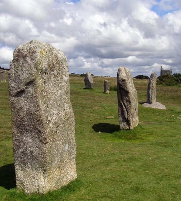
From the circles, energetic visitors can continue north to Stowe's Hill and the massive prehistoric enclosure of Stowe's Pound, passing close to the distinctive granite tor known as the Cheesewring on the way. Rillaton Barrow, a Bronze Age burial mound famous for a spectacular gold cup discovered within it, lies roughly half a kilometre to the north-east, visible on the skyline from the northern circle. Together these sites make it easy to spend a full morning or afternoon exploring Bodmin Moor's prehistoric landscape on foot.
Allow at least thirty to forty-five minutes for the circles themselves, considerably longer if extending the walk to Stowe's Pound or the Cheesewring. Minions village, a short walk or drive away, has a shop and licensed tea room serving hot and cold drinks, cakes, Cornish pasties and cream teas, with limited customer parking adjacent to the shop front.
History
The Hurlers consist of three adjacent stone circles, aligned broadly north-east to south-west, a grouping of three regular circles that English Heritage describes as unique in England. The northern circle retains fifteen original stones, with markers indicating the positions of others identified during excavation. The central circle is the best preserved, with fourteen original stones and markers for those missing, while the southern circle is less complete, with nine surviving stones, several of them fallen. The circles were built from local granite, and excavation evidence shows that some stones were deliberately shaped or hammer-dressed, suggesting a carefully planned monument, though differences between the three circles hint that the whole complex may have developed in stages rather than as a single undertaking.
The name "Hurlers" comes not from archaeology but from Cornish folklore: local legend holds that men playing the game of hurling on a Sunday were turned to stone as punishment, while the two isolated standing stones known as The Pipers, a short distance to the west, are said to be the musicians who accompanied them. The legend was already recorded in the 17th century by the antiquarian John Norden, showing how long the stones have captured local imagination even without any understanding of their true origin.
The Hurlers form part of a remarkably dense concentration of Late Neolithic and Bronze Age ceremonial and funerary monuments on this part of Bodmin Moor. Nearby sites include The Pipers, Rillaton Barrow, Stowe's Pound, the Cheesewring and the Craddock Moor stone circle. Rillaton Barrow, about half a kilometre to the north-east, is famous for the discovery of a richly furnished Bronze Age burial including the Rillaton Gold Cup, now held in the British Museum; the alignment of the northern circle points directly towards the barrow, which is visible on the skyline from the monument, suggesting a deliberate relationship between the two sites.
By the early 20th century, the circles had suffered from fallen stones, stone robbing and the effects of later land use, including tin-mining activity that left hollows and a slight bank within the circles. A major programme of excavation and reconstruction was carried out in 1935–36, directed by the archaeologist C. A. Ralegh Radford, whose work confirmed that the monument consisted of three separate circles rather than the remains of a single larger structure, allowed a number of fallen stones to be re-erected, and revealed a strip of granite paving between the northern and central circles whose purpose remains uncertain. Excavation in the central circle also found a layer of granite crystals associated with the hammer-dressing of the stones.
Today the Hurlers are owned by English Heritage but managed day-to-day by the Cornwall Heritage Trust, which cares for several prehistoric sites in this part of Cornwall. They remain freely accessible to visitors throughout the year, and continue to be studied as one of the most important and complete surviving examples of a prehistoric stone-circle grouping in Britain.
Important Features
- Three adjacent stone circles: a grouping described by English Heritage as unique in England, aligned north-east to south-west.
- The Pipers: two isolated standing stones a short distance west of the circles, associated with local legend.
- Stowe's Pound: a massive prehistoric hilltop enclosure on Stowe's Hill, to the north, close to the Cheesewring rock formation.
- Rillaton Barrow: a Bronze Age burial mound famous for the discovery of the Rillaton Gold Cup, now in the British Museum.
- Granite paving: a strip of deliberately laid stone found between the northern and central circles during excavation.
- 1935–36 excavation: led by C. A. Ralegh Radford, establishing the form of the circles seen today.
- Craddock Moor stone circle: a further prehistoric circle about a kilometre to the west-north-west, part of the same wider landscape.
Visitor Information
Parking
Free parking is available in Minions village, around a quarter of a mile from the circles. The walk to the stones crosses uneven, open moorland.
Facilities
There are no facilities at the circles themselves. The Minions Post Office, General Store and licensed tea room in the village serves food and drink.
Disabled Access
The site is reached on foot across uneven, exposed moorland with no formal step-free route. The ground can be wet and boggy after rain.
- Opening times: open any reasonable time during daylight hours, year-round.
- Public transport: limited bus services run from Liskeard, with the nearest stops at Upton Cross or Darite followed by a walk of around 1.7 miles. Liskeard is the nearest railway station.
- Toilets: none at the site; facilities are available in Minions village.
- Food and drink: the Minions Shop & Tea Room serves hot and cold drinks, cakes, Cornish pasties and cream teas.
- Shop: no shop at the circles; the Minions Post Office and General Store is in the village.
- Dogs: welcome on leads. Sheep and ponies frequently graze the surrounding moor, so keeping dogs under close control is important.
- Booking: not required — free entry, no ticketing.
- Family facilities: no baby-changing facilities at the site; the moorland terrain makes pushchair access difficult beyond the car park.
- Additional access: please do not climb on the stones; ancient surfaces are vulnerable to erosion and damage.
- Visit duration: thirty to forty-five minutes for the circles, longer if extending the walk to Stowe's Pound or the Cheesewring.
Things to Do Nearby
King Doniert's Stone
Nr. St Cleer
Two carved fragments of a 9th-century Celtic cross commemorating a Cornish king, a short drive away.
Find Out MoreTrethevy Quoit
Darite, nr. St Cleer
One of Cornwall's finest Neolithic burial chambers, a dramatic granite dolmen near St Cleer.
Find Out MoreMinions
The Hurlers' home village
The highest village in Cornwall, a good base for exploring the Hurlers, Stowe's Pound and the Cheesewring.
Find Out MoreSiblyback Lake
Nr. Liskeard
A reservoir and water park on the southern edge of Bodmin Moor, popular for walking and watersports.
Find Out MoreLiskeard
South-east of Minions
A historic market town with shops, cafés and the nearest railway station to Bodmin Moor's eastern side.
Find Out MoreFrequently Asked Questions
Official English Heritage Site
For the latest access information, events and any temporary restrictions, check the official English Heritage page for The Hurlers Stone Circles before you travel.
Explore More Cornwall Heritage
All English Heritage Sites Cornwall Attractions National Trust Cornwall
Page last updated: 24 August 2026.