Pedn Vounder
Wild Turquoise Water Beneath Treryn Dinas and Logan Rock
Pedn Vounder, near Treen, Land's End Area, Cornwall, TR19 6LF
Pedn Vounder is, by common consent, one of the most beautiful beaches anywhere in Cornwall, and it earns that reputation on sight: a crescent of fine white sand set against water so clear and so pale a turquoise that photographs of it are routinely mistaken for somewhere in the Caribbean rather than the far tip of Cornwall. It lies immediately below Treryn Dinas, the dramatic headland that carries an Iron Age cliff castle and the famous Logan Rock, a short distance from the village of Treen in the Land's End Area. Unlike most of Cornwall's showpiece beaches, Pedn Vounder has never been developed in any way - there is no beach car park at the sand itself, no café, no signage beyond the cliffs, nothing but sand, sea and granite - and that wildness, difficult access included, is central to what makes it so highly regarded among people who go looking for it.
Getting to Pedn Vounder takes a little more planning than most Cornish beaches, and this has changed in an important way for the 2026 season. The direct cliff path down from the coast path above the beach - historically the more obvious of the two routes in - is now closed because of coastal erosion concerns, and visitors are strongly advised not to attempt it. Where the old route is still used by some despite the closure, it is a genuinely challenging, roughly 100-foot scramble down a steep, loose cliff face, entirely unsuitable for anyone with limited mobility, for young children, or for carrying much in the way of beach kit. The safer and now-recommended way in is to park at the main Porthcurno car park and walk round to Pedn Vounder along the sand at low tide, avoiding the cliff descent altogether. Because this route depends entirely on the tide, it is worth timing a visit for a spring low tide, when the largest stretch of sand is exposed and the walk between the two beaches is at its easiest; at other states of the tide the way round can narrow considerably or disappear beneath the water. A small car park in Treen village itself, with around 60 spaces, sits roughly a 10-minute walk from the clifftop above the beach and remains useful for anyone heading out along the coast path towards Treryn Dinas, though it no longer connects to an open route down to the sand.
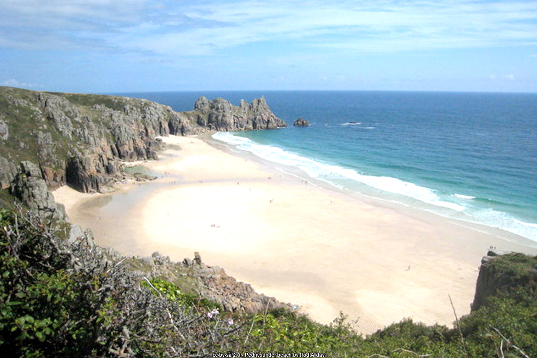
There are no facilities of any kind at Pedn Vounder - no toilets, no café, no shop, no lifeguard hut, nothing at all beyond the natural landscape itself. For a beach so widely photographed and so often named among Cornwall's best, this can come as a surprise to first-time visitors, but the lack of facilities is, in a very real sense, part of the beauty of this wild beach: nothing here has been built, tidied or commercialised, and the experience of arriving at Pedn Vounder still feels like a genuine discovery rather than a managed attraction. That same wildness demands a degree of self-sufficiency - water, food, sun protection and a means of carrying everything back out again should all be planned for in advance, since nothing can be bought once you're on the sand. There is no RNLI lifeguard patrol at Pedn Vounder, and with no phone signal reliable in the cove itself, visitors should be confident in their own judgement of the sea and the tide before swimming here.
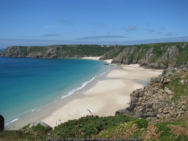
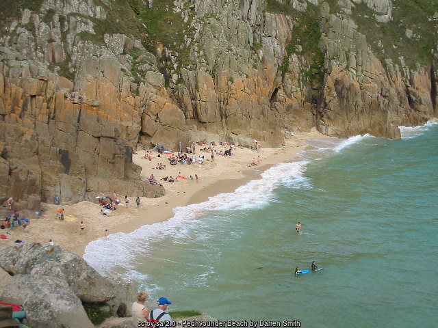
Immediately to the east of the beach rises Treryn Dinas, a scheduled Iron Age promontory fort - sometimes described as a cliff castle - cared for by the National Trust as part of its wider Treen Cliff holdings. It is a genuinely impressive piece of prehistoric defensive engineering, exploiting the headland's naturally steep slopes on three of its four sides so that only a narrow neck of land ever needed to be fortified by hand. What survives today is a sequence of ramparts and ditches cut across that neck: an innermost rampart standing up to 2 metres high, and beyond it a much larger outer rampart reaching as much as 6.1 metres in height, fronted by a ditch and crossed by a still-visible causewayed entrance. Archaeologists estimate the fort was built and used sometime in the Iron Age, part of a wider pattern of cliff castles strung along this stretch of the Cornish coast, and walking the ramparts today - with Pedn Vounder's turquoise water on one side and the open Atlantic on the other - gives a genuine sense of why this headland was considered worth defending.
On the same headland, a short walk beyond the ramparts, sits Logan Rock, one of Cornwall's most famous natural landmarks: a granite boulder weighing somewhere in the region of 70 tonnes, perched roughly 30 metres above the sea and so precisely balanced on its natural pivot point that it can be rocked - "logged," in the old dialect term that gives such stones their name - by a firm push from a single person. Logan Rock's fame is not purely a matter of its size and balance; in 1824 a young naval officer, Lieutenant Hugh Goldsmith, led a group of his crew in levering the rock from its pivot as a prank, an act that provoked such public outrage - the rock had long been a well-known local curiosity and a minor tourist draw even then - that the Admiralty is said to have ordered Goldsmith to have it restored at his own considerable expense, using a specially built system of capstans and pulleys to winch the boulder back into its original balanced position. The stone's fame had already spread well beyond Cornwall by the early nineteenth century, and it was captured in an 1833 engraving by the artist Thomas Allom, part of a series of Cornish views that helped introduce the county's dramatic coastal scenery to a wider Victorian audience.
The far end of Pedn Vounder's sand, away from the main path down and generally the quieter end of the beach, has long been informally used as a naturist area, a use that is well established and generally tolerated rather than officially designated. Elsewhere on the beach, and particularly closer to the Porthcurno end where most visitors arrive via the low-tide walk, Pedn Vounder functions as an ordinary family beach on a calm day, with clean, clear water that makes it a popular spot for swimming and snorkelling among those who make the effort to reach it.
Geologically, Pedn Vounder sits within the granite landscape that defines so much of the far west of Cornwall, and it is that granite - broken down over millennia into fine, pale sand, combined with unusually clear water over a light seabed - that gives the beach its distinctive turquoise colour on a sunny day, an effect that has become something of a signature image for the wider Land's End coastline in tourism photography. The surrounding cliffs and headlands form part of the South West Coast Path's run between Porthcurno and Penberth, a stretch that takes in some of the most dramatic and least developed coastal scenery anywhere in Cornwall, and walkers passing along the clifftop above Pedn Vounder on a clear day are rewarded with views stretching from Gwennap Head in the west round towards the Lizard Peninsula in the east.
The name Pedn Vounder itself comes from Cornish, generally understood to combine "pedn," meaning head or end, with a word related to a path, lane or way - fittingly, for a beach that has always been reached on foot rather than by road, and which continues to reward those willing to make that walk with one of the most genuinely spectacular stretches of sand and sea in the whole of Cornwall.
Visitor Information
Parking
A small car park in Treen village (around 60 spaces) sits about 10 minutes' walk from the clifftop above the beach. Most visitors now use the main Porthcurno car park instead and walk round along the sand at low tide.
Facilities
None at all - no toilets, café or shop at the beach itself. Bring everything you need. The nearest facilities are at Porthcurno, including toilets and a café near the car park and beach.
Disabled Access
There is no wheelchair or pushchair access to Pedn Vounder. The direct cliff path is closed for 2026, and the low-tide walk from Porthcurno is over open sand unsuitable for limited mobility. No Blue Badge parking is available at the beach itself.
Things to Do Nearby
- Porthcurno, the neighbouring beach and the usual starting point for the low-tide walk round to Pedn Vounder
- Penberth Cove, a short walk east along the coast path, a working Cornish fishing hamlet
- Treryn Dinas and Logan Rock, the Iron Age cliff castle and famous balancing boulder immediately above the beach, cared for by the National Trust
Places to Stay
Treen and Pedn Vounder sit within St Buryan parish, the closest genuine accommodation hub to the beach:
Frequently Asked Questions
Page last updated: 17 September 2026