Lundy Bay
A Small, Secluded Cove on the National Trust's Pentire Headland
Lundy Bay, near Pentire Point, Polzeath, Cornwall
Lundy Bay is one of the smallest and least-crowded beaches on the stretch of coast the National Trust manages around Pentire Point and The Rumps, tucked into a wooded valley roughly a mile before New Polzeath on the road up from Wadebridge. There is no village at Lundy Bay, no shop and no sign of development beyond a small car park - just a sloping path down through scrub, meadow and woodland to a sheltered cove of sand and rock. At low tide a decent stretch of sand is uncovered, backed by low cliffs and scattered rock; as the tide comes in the sand disappears and the cove is left mostly rock, so it rewards a visit timed carefully around the tide table rather than a spontaneous one. It sits on land owned and managed by the National Trust as part of its wider Pentire headland holding, which stretches from Com Head and The Rumps in the north round to Pentire Point itself and down towards New Polzeath and Polzeath in the south.
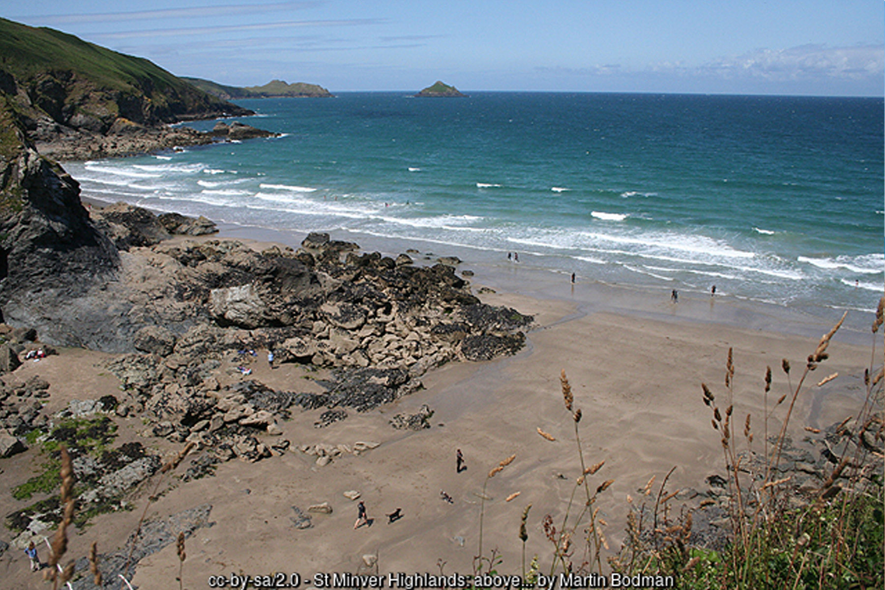
Getting down to the beach takes a bit more effort than most Cornish coves, which is a large part of its appeal. The small National Trust car park at Lundy Bay (postcode PL27 6QZ) sits just off the lane between Pentireglaze and New Polzeath, and it is popular enough to fill quickly on a sunny day - arrive early in summer, or be prepared to try the larger Pentireglaze car park a little to the south instead. From the car park, a gently sloping path drops through an open field and into a wooded valley of blackthorn, willow and hawthorn before a flight of wooden steps leads down onto the sand itself; National Trust's own guide rates the walk down as easy going and reckons on ten to fifteen minutes each way, though the return climb is enough to notice. There are no facilities at Lundy Bay itself - no toilets, café or shop - with the nearest at the National Trust's Pentireglaze site (postcode PL27 6QY), which has toilets with baby-changing facilities and a café with indoor and outdoor seating, a little over a mile away by road.
Lundy Bay's best-known feature lies just a short walk along the coast path from the beach: Lundy Hole, sometimes called Pigeon Hole, a collapsed sea cave that has become one of this stretch of coast's more striking natural curiosities. It began as an ordinary sea cave, hollowed out of the cliff by centuries of wave action; over time, pressure from the sea working through natural faults in the rock caused the roof to give way entirely, leaving behind a deep, roughly circular pit open to the sky, with a natural rock arch still standing on its seaward edge where the cave mouth once was. A safety wall runs around part of the hole, but the drop is real and sudden, and it is worth keeping a close eye on children and dogs near the edge. The wider headland shares the same volcanic geological story: Pentire itself is built from pillow lava, formed when molten rock erupted under an ancient sea floor and cooled quickly into rounded, pillow-like masses, while The Rumps to the north is made of a much harder, altered dolerite - a difference in rock type that helps explain why The Rumps stands out as such a distinct, resistant headland compared with the softer ground around it. The whole headland is registered as a Site of Special Scientific Interest for its combination of unusual geology and rare plant life.
The sheltered valley behind the beach is noticeably lush for such an exposed stretch of coast, and it shows in the vegetation: mature blackthorn, willow and hawthorn scrub carries thick braids of lichen, a good sign of clean air, while boggier ground lower down supports yellow iris, meadowsweet and common fleabane. Drier banks nearby carry knapweed, pale flax and common dog-violet, and in late summer the gorse-covered slopes above take on a second colour as heather comes into flower alongside it. The scrub and hedges are used by breeding blackcap and willow warbler, with stonechats and whitethroats working the gorse and bramble at the valley's edges, and small copper and wall brown butterflies are among the species regularly seen along the path in summer.
Beyond the valley, the wider Pentire headland - encompassing Pentire Point and the Iron Age promontory fort of The Rumps a little further round the coast - is one of the better wildlife-watching spots on this part of the North Cornwall coast. Grey seals are seen fairly regularly around the cliff bases and offshore rocks, and small numbers of bottlenose and common dolphins, along with occasional Risso's dolphins, pass the headland year-round; feeding seabirds diving on the water are often the first clue that dolphins are working the same patch. Basking sharks appear from April to October in settled, sunny conditions, their fins breaking the surface as they filter-feed on plankton close to shore. Seabirds are a constant presence too - gannets, fulmars, cormorants, shags, kittiwakes, razorbills and guillemots year-round, with occasional puffins, and during strong onshore winds between spring and autumn, passage counts of Manx shearwater and increasing numbers of Balearic shearwater can be considerable. Choughs, the red-billed, red-legged corvid that all but vanished from Cornwall for most of the twentieth century before recolonising naturally from the early 2000s onwards, are still scarce this far from their main Lizard Peninsula stronghold, but birdwatchers have recorded them along this section of coast as the population has slowly spread; the RSPB also lists the Pentire and Rumps area as one of the county's better spots to see corn bunting, another species that has declined sharply elsewhere in Britain.
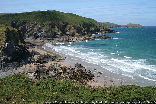
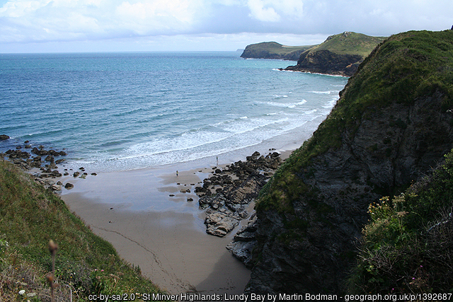
The Rumps itself, the twin-headed promontory that closes off the bay to the north, carries a much older story again. An Iron Age cliff castle occupies the site, defended by three earth ramparts cut across the neck of the headland, with excavations by the Cornwall Archaeological Society between 1963 and 1967 uncovering round-house platforms, pottery brought in from the Lizard, and even an amphora fragment suggesting trade reaching as far as the Mediterranean. The fort was occupied in two main phases between roughly the fourth century BC and the first century AD, and was first recorded by name - as "Pentire Forte" - in 1584. It was on these same cliffs, between Pentire Point and The Rumps, that the poet Laurence Binyon is said to have composed "For the Fallen" in September 1914, the poem whose fourth stanza - "They shall not grow old, as we that are left grow old" - is read at Remembrance services across the country every year; a small stone plaque was placed on the clifftop in 2001 to mark the spot.
Lundy Bay sits directly on the South West Coast Path, and makes a natural anchor for walks in either direction. Heading north, a well-known circular route continues past Pennywilgie Point and Epphaven Cove, climbs to Trevan Point with views back towards The Rumps, and drops via Gilson's Cove towards Doyden Point and the old fishing hamlet of Port Quin - a round trip of about three and three-quarter miles. Heading the other way, the coast path threads past Pentireglaze Haven and Com Head out towards The Rumps and Pentire Point itself, before curling back down towards New Polzeath and Polzeath. Either direction gives some of the best clifftop scenery on this part of the coast, though the ground is genuinely undulating in places and sturdy footwear is worth the effort.
Compared with Polzeath and New Polzeath a mile or so to the south, Lundy Bay is a different kind of beach experience entirely - no surf school, no beach café, no crowds, just sand, rock and cliff for those willing to walk in. Visit close to low tide to see the beach at its best, allow time to look in at Lundy Hole while you are there, and keep dogs on a lead on the approach, since livestock graze the fields around the path down. For many visitors used to Polzeath's busier sand, that quietness is exactly the point.
Visitor Information
Parking
Small National Trust car park at Lundy Bay itself (postcode PL27 6QZ), on the lane between Pentireglaze and New Polzeath. Fills quickly on sunny days; the larger Pentireglaze car park a little to the south is the nearest alternative.
Facilities
None at Lundy Bay itself - no toilets, café or shop. The nearest are at the National Trust's Pentireglaze site (postcode PL27 6QY), which has toilets, baby-changing and a café, just over a mile away.
Disabled Access
Not suitable for wheelchairs or pushchairs. The path from the car park slopes down through a field and wooded valley, with wooden steps onto the sand, taking ten to fifteen minutes each way. National Trust members and Blue Badge holders park free at the on-site car park, though the beach itself remains inaccessible by wheelchair.
Things to Do Nearby
- Pentireglaze Beach, a little over a mile south, with the nearest toilets and café to Lundy Bay
- Port Quin, reached along the coast path north via Pennywilgie Point and Trevan Point, a round trip of around three and three-quarter miles
- Polzeath Village Guide - shops, surf schools and places to eat a mile or so south
Places to Stay
Frequently Asked Questions
Page last updated: 8 September 2026.