Polzeath Beach
North Cornwall's Famous Family Surf Beach
Polzeath, Wadebridge, Cornwall, PL27 6SS Blue Flag 2026
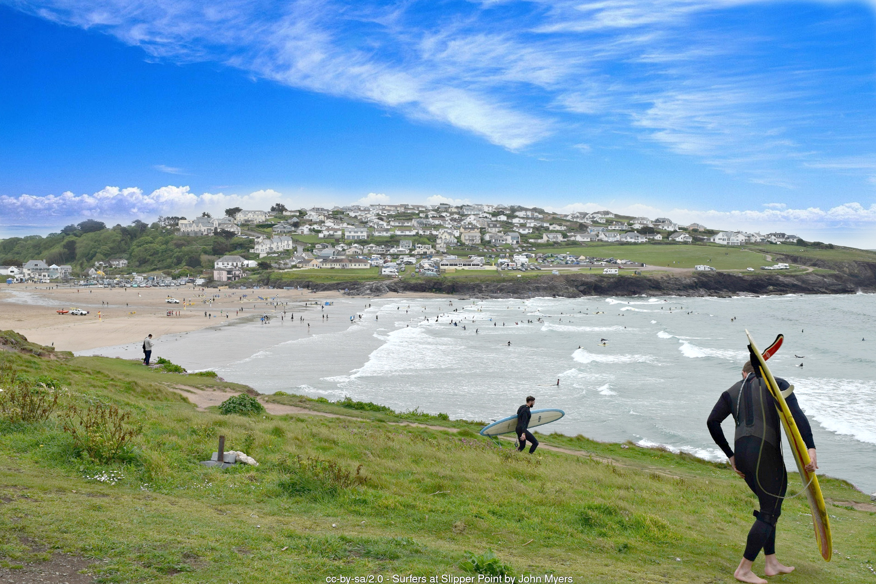
Polzeath is one of Cornwall's best-known beaches, a wide, west-facing bay of flat golden sand on the north coast a few miles from Wadebridge and the mouth of the Camel Estuary. At low tide it opens out into a vast expanse of sand roughly half a mile across, bounded to the north by the low headland separating it from Pentireglaze and, beyond that, the dramatic coastline running out to Pentire Point and The Rumps. To the south, a rocky spur separates the main beach from Greenaway, with Daymer Bay and Rock further along the estuary shore. It is this combination - reliable, well-shaped Atlantic surf, a huge safe expanse of sand, and easy access from the car park right behind the beach - that has made Polzeath one of the most popular family and surfing destinations in the county.
Polzeath began life as a modest fishing hamlet at the mouth of a small stream, little more than a scatter of cottages around Shilla Mill - a corn mill built at the confluence of the stream around 1590 that continued grinding grain until 1885. Well into the twentieth century the village's main street forded that stream rather than crossing it by bridge; the current road bridge dates only from 1934, a small but telling sign of how recently Polzeath was transformed from an isolated coastal hamlet into a full-blown holiday resort. That transformation gathered pace through the twentieth century as motor transport made the north Cornwall coast accessible to summer visitors in a way it never had been before, and tourism - built overwhelmingly on the beach itself - has been the mainstay of the local economy ever since.
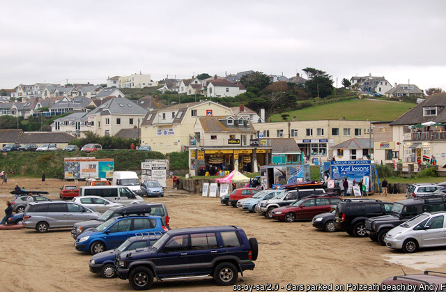
The old Methodist chapel on the seafront, built in 1911 and rebuilt in 1933, tells its own version of that story: no longer a place of worship, it has operated since 2006 as Tubestation, a well-known surf church and community hub that still anchors the top of the beach today. Surfing itself has shaped Polzeath's identity for decades. The beach's wide, gently shelving bay and consistent, well-formed Atlantic swell make it one of the most forgiving beginner surf beaches on this stretch of coast, while still offering enough quality on its day to hold the interest of far more experienced surfers - a rare combination that has kept it near the top of Cornwall's surfing reputation since the sport first took hold here. Long-established operators including Surf's Up, teaching on the beach for more than 25 years, and Wavehunters run lessons and equipment hire directly on the sand, and Polzeath's surf schools are often recommended as among the best places in Cornwall for a first surf lesson.
The beach and village have also drawn a wealthier, more high-profile crowd over the years. Former Prime Minister David Cameron and his family holidayed regularly in and around Polzeath for several years while he was in office, and the wider stretch of coast around the Camel Estuary - taking in Rock, Daymer Bay and Trebetherick as well as Polzeath itself - has become known for expensive second homes and, in Rock's case particularly, the tabloid nickname "Chelsea-on-Sea" for the wealthy Londoners who holiday and own property there.
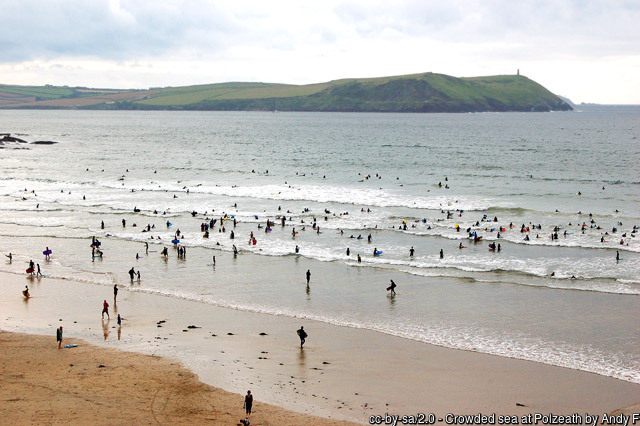
Polzeath itself has kept a more down-to-earth, surf-and-family character than that label suggests, though it has not been entirely immune to the pressures of second-home ownership and seasonal crowds: a police dispersal order was imposed in the village in the summer of 2022 following reports of antisocial behaviour among groups of teenagers drawn by its reputation as a rite-of-passage holiday spot for independent-school leavers. For the vast majority of visitors, though, Polzeath remains what it has been for generations - a straightforward, exceptionally good family beach.
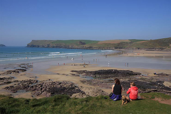
Geologically, Polzeath sits within a bay carved from the same resistant Devonian slates and sandstones that shape so much of this coastline, with the low reef and rock ledges at its northern and southern margins - rather than the open sand itself - doing most of the work of breaking up the swell into the rideable waves surfers come for. At low tide the retreating sea exposes long, flat stretches of clean sand interspersed with gullies and rock pools around the fringes, particularly toward Pentireglaze to the north and Greenaway to the south, both worth exploring for shore crabs, anemones and small fish left behind by the tide. The beach shelves gently and evenly for most of its width, though rip currents can develop near the rocks at each end and around the stream outflow, and RNLI lifeguards patrol the main body of the beach through the season with flags marking the safest areas for swimming and surfing separately.
Just around the rocky point at the southern end of Polzeath lies Greenaway, a quieter, largely overlooked cove of sand, pebbles and excellent rock pools that is only accessible on a dropping to low tide - the route across is submerged as the tide comes in, so it rewards a bit of planning with the tide tables rather than a spontaneous stroll. Because it has no facilities of its own and involves a tide-dependent scramble to reach, Greenaway stays far quieter than Polzeath even in peak season, and is popular with families happy to carry everything they need for an afternoon of rockpooling and crabbing away from the crowds. Further south again, past Greenaway, the coast opens into Daymer Bay and the mouth of the Camel Estuary proper, with Rock and the passenger ferry to Padstow beyond that - a walk that traces almost the entire length of this short but varied stretch of coast within a single low-tide window.
To the north, Polzeath connects directly to Pentireglaze Beach and New Polzeath around the headland, and from there the South West Coast Path climbs out to Pentire Point and on to The Rumps, a dramatic double-headed promontory reached along a narrow isthmus. The Rumps, now in the care of the National Trust, was the site of an Iron Age promontory fort excavated between 1963 and 1967, its inhabitants growing grain and weaving cloth behind ditches and ramparts that still trace the neck of the headland; occupation appears to have ended around the time of the Roman invasion of Britain. The cliffs here also expose striking pillow lava formations, evidence of ancient underwater volcanic activity, visible along the coast path between Pentire Point and The Rumps. The headland is a well-regarded spot for seabird watching, with fulmars and guillemots offshore, farmland birds including skylarks and linnets inland, and puffins nesting on the small islands beyond Pentire Head in early summer; seals and dolphins are seen in the bay from time to time, most often outside the busiest summer months. It was on Pentire Head, looking out over this same stretch of coast, that the poet Laurence Binyon is said to have written "For the Fallen" - the poem that gave English-speaking countries the words "We will remember them" - in September 1914, and Sir John Betjeman, who lived nearby at Trebetherick for much of his life, wrote often and fondly of this whole corner of the Camel Estuary.
Lundy Bay, further north again beyond Pentireglaze along the coast path, is a smaller, wilder cove reached down a fairly steep valley path, with a natural rock arch and blowhole among its attractions at the right state of tide - a worthwhile extension for anyone walking the coast path north from Polzeath with an afternoon to spare. Back at Polzeath itself, the beach's popularity means the car park and village can become very busy at peak times in summer, and on the biggest spring tides the sea has occasionally reached far enough up the beach to affect the lower part of the car park - a reminder that, for all its family-friendly reputation, Polzeath remains a genuinely tidal, working stretch of Atlantic coast rather than a sheltered resort beach.
Visitor Information
Parking
Pay-and-display car park directly behind the beach at Dunders Hill, plus further pay-and-display parking in the village. Arrive early in summer, as the beach and car park are very popular and can fill quickly.
Facilities
Public toilets, outdoor showers, surf hire and several cafes, restaurants and shops around the beach and village. RNLI lifeguards patrol through the main season, broadly Easter to the October half-term.
Disabled Access
Level, step-free access from the car park directly onto the beach, making it one of the more accessible sandy beaches in the area. A bookable beach wheelchair is available through local surf hire operators. Confirm current Blue Badge parking provision with Cornwall Council before you travel.
Things to Do Nearby
- New Polzeath, the quieter sandy cove immediately north around the headland
- Greenaway Beach, the tide-dependent cove of sand and rock pools just south of Polzeath
- Daymer Bay, further south on the Camel Estuary shore near Trebetherick and Rock
- Pentire Point & The Rumps (National Trust), the Iron Age headland walk north of the beach
- Polzeath Village Guide - the wider village, its history and holiday information
- Cornwall Surfing Guide - surf schools, hire and conditions across the county, including Polzeath
Places to Stay
Frequently Asked Questions
Page last updated: 8 September 2026.