Pentireglaze Beach
A Quiet Sandy Cove on the National Trust's Pentire Headland
Pentireglaze Beach (Pentireglaze Haven), Polzeath, Cornwall
Pentireglaze Beach - known locally, and on National Trust signage, as Pentireglaze Haven, and sometimes simply as Baby Bay - is a small, sheltered pocket of sand tucked in at the northern end of Polzeath beach on Cornwall's Pentire headland, between the Camel Estuary and the open Atlantic. It is one of the quietest and least crowded stretches of sand in an area otherwise dominated by Polzeath's big surf beach a short walk to the south, and it owes that quiet largely to geography: at high tide, a rocky outcrop called Slipper Point cuts Pentireglaze off completely from Polzeath, leaving it accessible only from inland via the coast path. As the tide falls, the two beaches join into one long, uninterrupted stretch of sand, and Pentireglaze becomes, in effect, an extension of Polzeath's northern end rather than a separate beach at all.
The cove itself is modest - a compact, roughly enclosed bay of clean sand backed by low cliffs and rock, with a small stream around a mile and a half long draining onto the beach from the fields above. The setting is part of the National Trust's substantial Pentire estate, which covers most of the coastline running north from here past the Rumps and Pentire Point towards Port Quin, and the Trust manages the beach, the surrounding farmland and the coast path alongside it. There is no direct road access and no car park at Pentireglaze itself; reaching it on foot, whether along the sand from Polzeath or down from the coast path above, is simply part of what keeps it quieter than its famous neighbour.
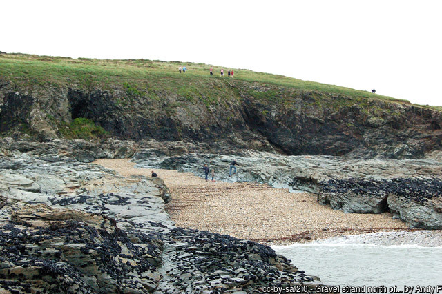
Two routes bring most visitors to Pentireglaze. The shorter is along the beach itself: from Polzeath, at low to mid tide, it is a straightforward walk round the rocks at Slipper Point onto Pentireglaze's own sand, and a short coast path link also drops down from the streets of New Polzeath above. The longer route is the one National Trust signposts for its own "Pentire and Baby Bay" walk, starting from the main Pentireglaze car park beside the Pentyr Cafe - a roughly three-and-a-quarter mile circuit that climbs past the Trust's Lead Mines car park, crosses Pentire Farm's fields to join the coast path, follows the cliffs above Pentire Point with views across Padstow Bay, and drops down to the beach before returning inland - reckoned at around two and a half hours all told, more a proper walk than a stroll to the sand. Whichever way it is reached, the going underfoot is uneven in places, with slopes, gates and unfenced clifftop sections, and sturdy footwear is worth having.
Tide state matters more here than at most beaches nearby. At low water, Pentireglaze opens out into a wide sweep of sand that runs unbroken into Polzeath, and this is when the beach is at its best for a long walk, a picnic away from the crowds, or rockpooling among the boulders and low reef at the cove's fringes, which the National Trust itself singles out as a good rockpooling spot. As the tide rises, the sand narrows quickly and Slipper Point re-forms the boundary with Polzeath, so a visit needs planning around the tide table rather than a fixed arrival time. There is no lifeguard cover at Pentireglaze itself - the RNLI's seasonal patrol operates on the main Polzeath beach immediately to the south, and swimming here is best kept to times when that cover is close by, since currents around the exposed rocks at either end of the cove can catch out anyone unfamiliar with them.
Winter storms have also visibly reshaped this stretch of coast in living memory: a well-documented storm sequence in the winter of 2014 threw up a sand bar as much as a metre high close to the high-tide line at the northern end of Polzeath beach, a feature that had not been recorded there before and a reminder of how much this coastline can change from one season to the next.
Geologically, Pentireglaze sits within the broader Pentire Point and Rumps headland, an area recognised as a Site of Special Scientific Interest for both its rock formations and its wildlife. The headland is built largely from pillow lava, formed when volcanic rock erupted and cooled rapidly underwater during the Devonian period, hundreds of millions of years ago; the dramatic promontory of the Rumps a little further north is made of a different, harder volcanic rock, dolerite, and the cliffs elsewhere on the headland are cut into Upper Devonian slate. It is a geologically rich stretch of coast for a relatively short distance, and one reason the whole headland draws walkers and geology students as well as beachgoers.
That same geology brought a very different kind of visitor here in the nineteenth century. Pentireglaze gives its name to a set of lead workings that mined this coastline on and off for centuries, with recorded activity going back to around 1580 at the neighbouring Pentire Mine. The most significant phase came in the mid-1800s, when the Pentireglaze mine extended its workings out beneath the seabed itself, chasing veins of galena and cerussite - a lead carbonate ore prized here for producing unusually fine, needle-like crystals - alongside a useful yield of silver. Before the mine finally closed in 1857, it is recorded as having raised more than a thousand tons of lead ore and around nineteen thousand ounces of silver, a substantial haul for what is, on the surface today, one of the quietest corners of this coast.
The National Trust's "Lead Mines" car park, passed on the walk in from Pentireglaze towards Pentire Point, takes its name directly from this history, and it is one of the few visible clues left to an industry that has otherwise all but vanished from the landscape.
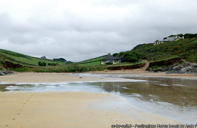
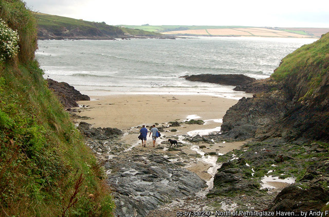
Pentireglaze has also, briefly, had its moment in front of the camera. The original 1975 BBC television adaptation of Winston Graham's Poldark novels filmed scenes here, and Graham himself later wrote in Poldark's Cornwall that this stretch of coast was "an area which could hardly have changed in a century" - a description that, for a beach with no facilities and no road access even now, still rings largely true five decades on. The wider headland has an older literary claim as well: the poet Laurence Binyon is said to have written his Remembrance Day ode "For the Fallen", with its now-famous line "they shall grow not old", while sitting on Pentire Point above Polzeath in 1914, at the start of the First World War - a detail commemorated today on a stone plaque at the point itself, a short walk up from the beach.
Wildlife benefits from the same lack of disturbance that makes Pentireglaze appealing to quieter visitors. The National Trust manages the clifftops and farmland around the cove as part of a wider push to restore species-rich coastal grassland along this stretch of Cornwall, and the headland supports breeding seabirds and songbirds through the spring and summer, along with a good showing of wildflowers on the cliff slopes above the beach. Grey seals are regularly seen offshore around Pentire Point and the Rumps a little further north, sometimes hauled out on rocks at low tide, and the sheltered rock pools around Pentireglaze's own fringes are worth a slow look for anemones, small fish and crabs whenever the tide allows.
For anyone staying in Polzeath or New Polzeath, Pentireglaze makes a natural, easy escape from the main beach's summer crowds, provided the tide is checked in advance. Combined with the coast path north to Lundy Bay and the Rumps, or south along the sand to Polzeath and New Polzeath, it also forms a good short leg of a longer headland walk without needing a second car. There is nothing to buy and nowhere to shelter at Pentireglaze itself, which is very much the point - it remains one of the few genuinely quiet corners of a coastline that, a short walk away, can get very busy indeed.
Visitor Information
Parking
No car park at the beach itself. Nearest is the National Trust's main Pentireglaze car park (Pentyr Cafe), around 15-20 minutes' walk via bridleway and coast path; Lead Mines and Lundy Bay car parks, also National Trust, are similar distances away. Many visitors instead walk in from New Polzeath or across the sand from Polzeath at low tide.
Facilities
None at Pentireglaze itself - no toilets, cafe or shop. The nearest are at the main Pentireglaze car park (toilets, baby-changing, a Changing Places facility and the Pentyr Cafe), or in Polzeath and New Polzeath villages a short walk south.
Disabled Access
Not suitable for wheelchairs or standard pushchairs - the only routes in are a sloping, uneven bridleway/coast path or a walk across the sand from Polzeath. The main Pentireglaze car park has designated Blue Badge bays close to the entrance and fully accessible toilets, including a Changing Places facility, though this is some distance from the beach itself.
Things to Do Nearby
- Lundy Bay, about a mile north along the coast path, a rocky bay with sandy coves at low tide and the collapsed sea cave of Lundy Hole
- New Polzeath, immediately south, the nearest beach with its own car park and easiest access on foot to Pentireglaze
- National Trust Pentire - the headland estate covering Pentireglaze, Pentire Point and the Rumps, with waymarked walks, a cafe and visitor facilities
- Polzeath Surf Guide - surf lessons, hire and conditions on the main beach next door
Places to Stay
Frequently Asked Questions
Page last updated: 8 September 2026.