Rock Beach
Sand Dunes, Sailing Waters and the Ferry Across to Padstow
Rock Beach, Rock, near Padstow, Cornwall, PL27
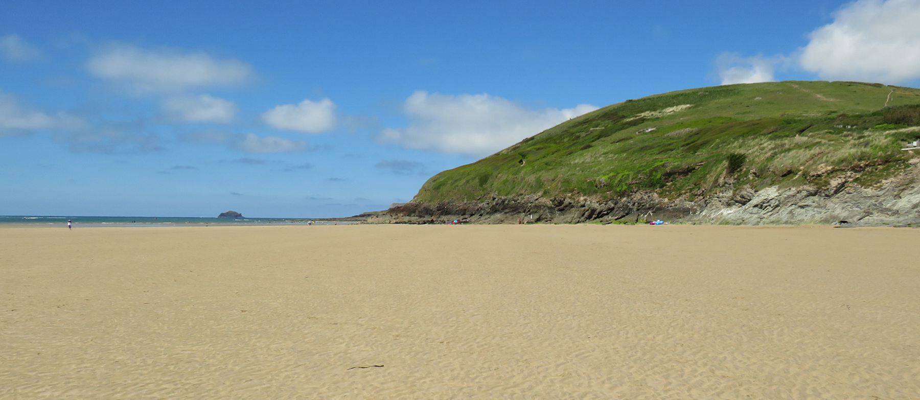
Rock is a small village on the eastern shore of the Camel estuary in north Cornwall, sitting directly across the water from Padstow and reached from the Padstow side by a short passenger ferry crossing. Its beach is, in a very real sense, not a single distinct beach at all but the northern continuation of neighbouring Daymer Bay: a long, gently shelving sweep of pale sand and low dune backing the estuary shore, exposed for the best part of two miles at low water and narrowing to a working slipway and sailing wharf as the tide comes in. West-facing across the estuary towards Padstow and Stepper Point, and sheltered by the bulk of the peninsula from the worst of the open Atlantic, Rock's beach has a calmer, more sheltered character than the surf beaches further along this coast at Polzeath and Constantine Bay - which is exactly what has made it, for well over a century, one of the best-loved sailing and family waters in Cornwall.
The name itself has shifted gradually over seven centuries. Records from 1303 give the settlement as "Penmayn," Cornish for "the end, or head, of stones," and by 1337 it appears as "Blaketorre," or Black Tor, a name that survives today in the Black Tor Ferry that still crosses the estuary. By the eighteenth century this had become "Black Rock," and the name was eventually shortened to plain Rock. The village grew from a scattering of fishing and ferry cottages into something closer to a resort in the late nineteenth century - local records note that in 1881 the hotel on the shore was enlarged, a new sea wall built, and a bathing house erected, laying the groundwork for the holiday village that exists today.
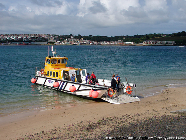
That ferry crossing is one of the oldest continuously operating passenger routes in Cornwall, with a documented ferry at this crossing point since at least 1337 - the better part of seven hundred years. Today it's known as the Black Tor Ferry, run by Padstow Harbour Commissioners as a foot-passenger and cycle service (it doesn't take vehicles), crossing the Camel in around ten minutes between Rock's slipway and Padstow's harbour or, at low tide, alternative landing steps closer to the town. It operates to a tide-adjusted timetable, running daily through the summer season and on a reduced Monday-to-Saturday basis in winter, with the exact departure points and last sailings shifting with the state of the tide - it's worth checking the current timetable before planning a crossing either way. For coast path walkers, it's also a genuine, historic link in the South West Coast Path itself, carrying the trail across the estuary rather than forcing a long detour inland via Wadebridge.
Rock's other reputation - as one of the most fashionable and expensive seaside villages in the country - has been well documented by the national press over the years, with nicknames like the "Saint-Tropez of Cornwall," "Kensington-on-Sea" and "Chelsea-on-Sea" attached to it in newspaper features about second-home prices, exclusive summer lets and a steady flow of well-known visitors drawn by the sailing and the seclusion. That framing says more about the village's property market and its media profile than it does about the beach itself, which remains, day to day, a fairly ordinary and thoroughly publicly accessible stretch of Cornish sand - families building sandcastles, dinghies being rigged on the slipway, and dog walkers heading off towards Daymer Bay along the tideline, much as they always have.
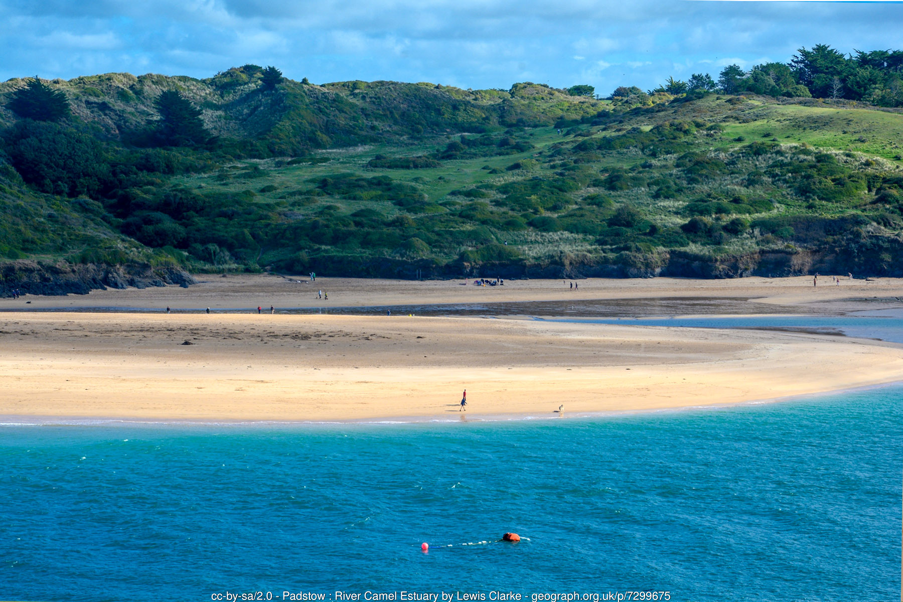
Behind the beach, the land rises into a substantial dune system - Rock Dunes, recognised as a Site of Special Scientific Interest for its dune grassland and flora - which continues along the shore towards Daymer Bay and the distinctive round hill of Brea Hill at the estuary mouth. Threaded through those same dunes is St Enodoc Golf Club, one of the best-known links courses in the country, its fairways running over genuinely wild dune terrain rather than a manicured park setting. Tucked into a fold of the dunes beside the course is the small, ancient chapel of St Enodoc, first recorded in 1299 and, extraordinarily, once so thoroughly engulfed by drifting sand that in the early nineteenth century the vicar reportedly had to be let in through a hole in the roof to hold the legally required annual service. Restored later that century, it's now perhaps best known as the burial place of the poet John Betjeman, a devoted admirer of this coastline, whose 1958 poem "Trebetherick" celebrates the church and the surrounding dune landscape; his grave in the small churchyard remains a quiet point of pilgrimage for many visitors.
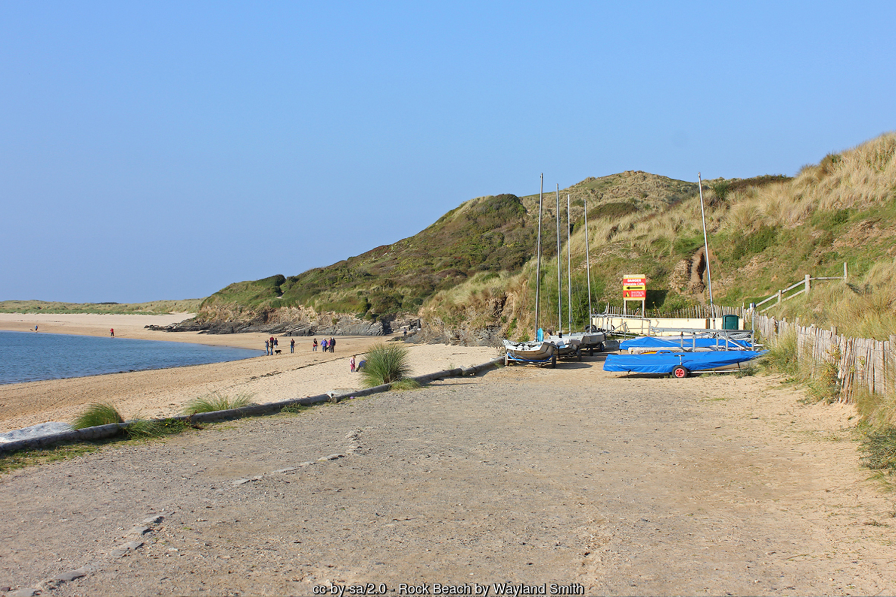
The sheltered, wide waters off Rock have made it a genuine centre for sailing and watersports rather than an occasional add-on. Rock Sailing & Waterski Club, based in a converted warehouse on the wharf, runs dinghy racing and youth sailing programmes that make use of the estuary's relatively flat water and steady breezes, while Camel Ski School, established on this stretch of the estuary for around a quarter of a century and accredited by British Water Ski & Wakeboard, offers waterskiing, wakeboarding, wake surfing, paddleboarding and kayaking for beginners through to advanced riders. Between the two clubs, plus casual paddleboard and kayak hire along the beach in season, Rock has a genuinely different flavour from the surf-focused beaches on the open coast a couple of miles to the north - this is a beach built around boats as much as bodyboards.
At the mouth of the estuary, roughly a mile out from Padstow and visible from higher ground around Rock on a clear day, lies the Doom Bar - a notorious sandbank formed largely from marine shell fragments carried in by longshore drift over thousands of years. It has been blamed for more than 600 recorded wrecks, strandings and near-misses since detailed records began in the early nineteenth century, and local legend attributes its formation to a mermaid's curse after she was shot by a local man; more prosaically, an estimated 10 million tonnes of sand have been dredged from it since the 1800s, both to keep the shipping channel open and, historically, to supply lime-rich sand for farmland. It no longer poses the same danger to shipping that it once did, but it remains a striking reminder of how much this whole stretch of coast is shaped by moving sand rather than fixed rock.
That same restless sand governs how the beach behaves through the tidal cycle. At low water, Rock and Daymer Bay effectively merge into one broad expanse of firm sand running for close to two miles along the estuary shore, and it's easy to walk a long way from the village without quite noticing how far you've gone. The Camel is a genuinely tidal estuary with a large range, and the incoming tide can move quickly across the flat sand, cutting off sandbanks and low-lying stretches well before the beach itself is threatened - a pattern very different from an open-coast surf beach, and one that occasionally catches out walkers and dog owners who've wandered further than they realised. Rock's own RNLI lifeboat station, one of the busier inshore stations on this coast, is a reminder that the estuary demands a degree of respect even in its calmer moods.
The estuary is also a well-regarded spot for wildlife watching, sitting within the Cornwall National Landscape (the area formerly known as an Area of Outstanding Natural Beauty) and supporting good numbers of wading birds across its mudflats and sandbanks - curlew, oystercatcher, redshank and turnstone are regular sights working the tideline at low water, with occasional grey seals reported further out in the main channel. The dune grassland behind the beach, part of the same Rock Dunes SSSI, adds a further layer of interest for anyone who enjoys a slower look at the coast beyond the sand itself.
For visitors based on the Padstow side, the ferry also opens up Rock as a day trip in its own right, and combines naturally with the Camel Trail - the eighteen-mile former railway path running from Padstow through Wadebridge towards Wenford Bridge - for a longer cycling or walking day out. From Rock itself, the coast path and beach walking continue north past Daymer Bay towards Polzeath, making it easy to link several of this stretch's beaches together without needing to move the car.
Visitor Information
Parking
Rock Quarry Car Park, run by Padstow Harbour Commissioners, sits directly beside the beach and is pay-and-display. An overflow car park roughly a quarter of a mile up Rock Road, opposite the Rock Institute, typically opens in the busier summer months.
Facilities
Public toilets in the beach car park. Cafes, a bakery and pubs are a short walk away in the village, including a kiosk by the ferry slipway. Dogs are generally welcome year-round.
Disabled Access
Generally good, with a level, gently shelving path from the main car park onto firm sand, though the slipway area gets very busy in peak season. No dedicated Blue Badge bays are confirmed at the beach car park - worth checking with Padstow Harbour Commissioners before you travel.
Things to Do Nearby
- Daymer Bay, the beach's immediate neighbour along the estuary shore, St Minver
- St Enodoc Golf Club, a renowned links course threaded through the dunes behind the beach
- St Enodoc Church and John Betjeman's grave, a short walk through the dunes near Daymer Bay
- Padstow, reached directly by the historic Black Tor passenger ferry
- The Doom Bar sandbank, a notorious estuary-mouth hazard visible from higher ground near Rock
- Rock Sailing & Waterski Club and Camel Ski School, on the wharf, for dinghy sailing, waterskiing and wakeboarding
Places to Stay
Frequently Asked Questions
Page last updated: 8 September 2026.