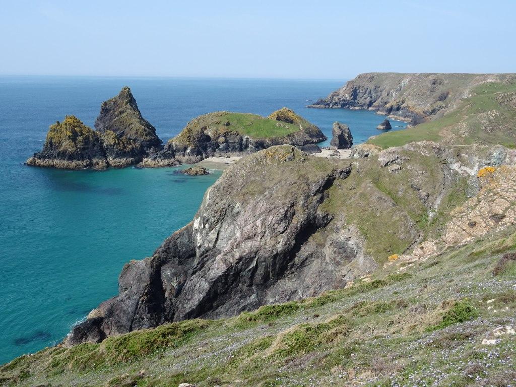
A very different geology
Much of Cornwall is associated with granite, slate and sedimentary rocks. The Lizard is different. Its geology includes serpentinite, gabbro, basaltic rocks and metamorphic rocks such as schist and gneiss.
Together, these rocks form part of what geologists call the Lizard Complex. They represent fragments of ancient oceanic lithosphere — the rigid outer part of the Earth that includes the oceanic crust and uppermost mantle.
The rocks formed in an oceanic setting during the Early Devonian, around 400 million years ago, at a spreading ridge in an ocean that lay to the south of what is now Britain. During later plate movements associated with the Variscan mountain-building event, pieces of this oceanic material were pushed over continental rocks and incorporated into the geology of south-west England. Geologists call a slice of ocean floor emplaced on land in this way an ophiolite, and the Lizard is the best-known example in Britain. Its northern edge is marked by the Lizard Boundary Fault, which separates it from the Devonian slates of the rest of Cornwall.
Why The Lizard matters
Oceanic mantle rocks are normally hidden beneath the Earth's crust. The Lizard preserves an unusually accessible example of these rocks at the surface, making the peninsula important for understanding plate tectonics and the evolution of the Earth's crust.
What is serpentine?
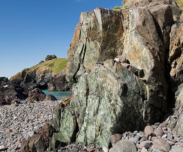
The word serpentine is commonly used for the distinctive green, red and dark-coloured rock found around The Lizard. More precisely, the rock is generally called serpentinite, while serpentine refers to a group of minerals that form a major part of it.
The original rocks were rich in minerals such as olivine and pyroxene, which are characteristic of the Earth's mantle. When these rocks interacted with water, chemical reactions altered some of their original minerals and formed serpentine-group minerals. This process is known as serpentinisation.
The resulting rock can display attractive green, grey, black and reddish colours, sometimes with intricate veins and mottled patterns. Its appearance has made serpentine valued as a decorative stone and used historically in local craftwork.
The geological map of The Lizard
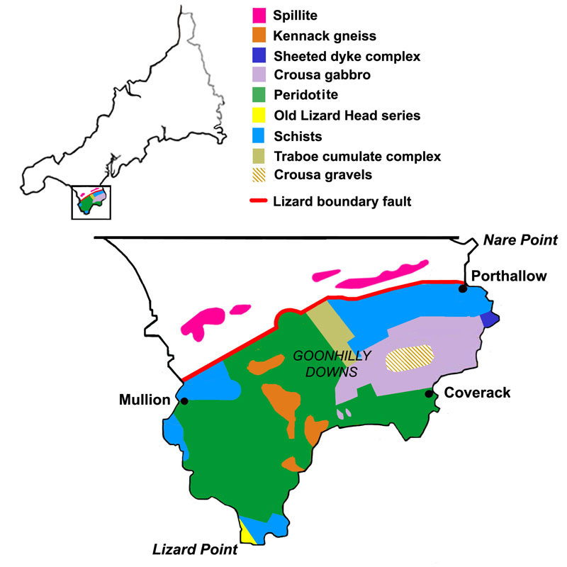
The peninsula contains several related but distinct rock units. Serpentinite is particularly associated with the mantle-derived rocks, while gabbro and other igneous rocks represent different parts of the ancient oceanic system. Metamorphic rocks record the effects of heat, pressure and deformation.
The simplified map below illustrates the distribution of the main geological units. The green peridotite and serpentinite covers much of the centre of the peninsula, around Goonhilly Downs; the Crousa gabbro lies in the east near Coverack; and the schists of the Old Lizard Head Series form the cliffs around Lizard Point. The red line is the Lizard Boundary Fault. Boundaries in a simplified map should be treated as an overview rather than a substitute for detailed geological mapping.
Kynance Cove: geology on the coast
Kynance Cove is one of the best-known places to appreciate the rocky landscape of The Lizard. Offshore islets, steep-sided rock faces and boulders create a dramatic setting, with the colours of the rocks contrasting with the sea and pale sand.
The coast exposes parts of the Lizard Complex and shows how resistant rock masses, fractures and coastal erosion interact. Waves exploit weaknesses in the rock, gradually widening cracks and helping to form small coves, clefts and isolated stacks.
The coastal landscape is constantly affected by wave action and weathering. Some rock surfaces can be slippery, and access to the beach depends on tides and conditions. Check local access information before visiting and avoid climbing unstable or exposed rock faces.
Coverack: where the mantle meets the crust
On the east coast, the shore at Coverack is one of the few places in Britain where the boundary between mantle rocks (serpentinite) and the overlying ocean crust (gabbro) – the ancient “Moho” – can be walked across. Look for the change from smooth, greenish serpentinite to the coarser, speckled gabbro.
Geology and unusual plants
The importance of The Lizard's geology extends beyond its rocks. Serpentinite-derived soils tend to have high levels of magnesium and iron and relatively low levels of several nutrients, including calcium. Their chemistry creates challenging conditions for many plants.
The result is a distinctive mixture of heathland and grassland vegetation. The peninsula is particularly well known for Cornish heath, which in Britain grows wild almost only on the Lizard, alongside a range of specialised plants and species that are uncommon elsewhere in Britain. English Nature also noted coastal plants such as thrift and sea campion growing well inland here, reflecting the chemistry of the serpentine soils.
The relationship between geology and biodiversity is one reason the area is important for nature conservation: much of the peninsula is a National Nature Reserve, with more than 250 species of national or international importance. The combination of unusual rocks, local soils, coastal exposure and a mild maritime climate creates habitats with considerable botanical interest.
The Lizard landscape
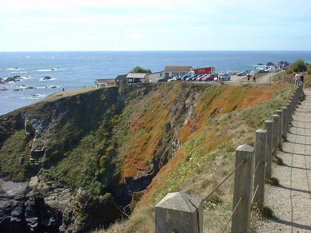
The Lizard is the southernmost part of mainland Britain, and Lizard Point is its most southerly tip. Its gently rolling plateau, open heathland, rocky coves and exposed headlands reflect the combined influence of its unusual geology, long-term erosion and maritime climate.
Exploring the peninsula provides an opportunity to see how geology shapes not only the physical landscape but also the soils, vegetation and character of a place.
Further reading
- Geological Society of London: The Lizard, Cornwall — how the rocks formed and were brought to the surface.
- English Nature: Geology and biodiversity – making the links (2004) — serpentine soils and their distinctive plant communities.
- British Geological Survey: Geology Viewer — interactive bedrock map of the Lizard Complex and surrounding rocks.
- Natural England: The Lizard National Nature Reserve — information about the reserve and its natural features.