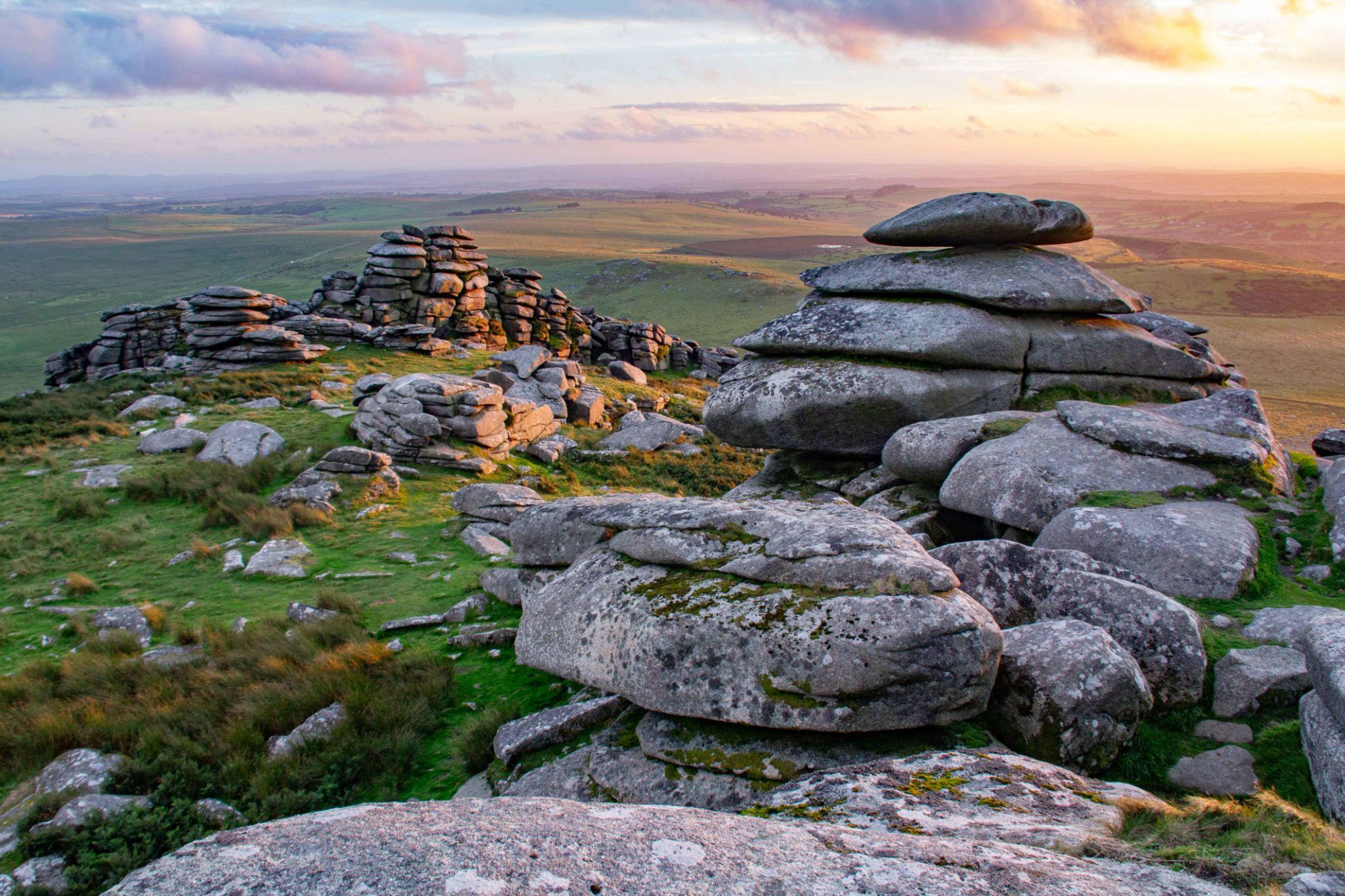
The granite beneath Bodmin Moor
Bodmin Moor is underlain by a large body of granite that formed deep beneath the Earth's surface around 290 million years ago, during the late stages of the Variscan mountain-building period. Molten rock cooled slowly underground, allowing crystals to grow and producing the coarse-grained rock seen in many of the moor's exposed outcrops. The British Geological Survey describes most of it as coarse-grained biotite granite, and dates it to about 287 million years ago.
Bodmin Moor is one of a chain of granite masses – from Dartmoor to Land’s End and the Isles of Scilly – that rise from the Cornubian Batholith, a vast body of granite beneath Devon and Cornwall. Its highest point, Brown Willy (420 m), is the highest ground in Cornwall.
Granite is an igneous rock made mainly of quartz, feldspar and mica. Its interlocking crystals generally make it resistant to erosion, although joints and fractures provide weaknesses along which water and weathering can gradually break the rock apart.
The granite forms the central upland landscape, while older sedimentary rocks, locally known as killas, surround it. Close to the granite these rocks were baked by its heat, and the contact zone around the moor carried the copper and tin lodes worked at Minions and Caradon Hill in the 19th century. The contrast between the granite uplands and surrounding rocks is an important part of Cornwall's geological story.
Did you know?
The exposed granite of Bodmin Moor covers a substantial area beneath the open moorland. Its weathered surface includes rocky tors, slabs and scattered boulders known collectively in places as clitter.
How granite tors are formed
Granite may appear solid and unbroken, but it contains natural fractures known as joints. As water enters these cracks, chemical and physical weathering gradually weaken the rock. Over long periods, blocks become separated along the joints and the surrounding, more weathered material can be removed by erosion.
This process can leave prominent masses of relatively resistant granite standing above the surrounding ground. These landforms are called tors. Some consist of large rounded masses, while others display impressive piles of angular or roughly balanced blocks.
Smaller blocks that have broken away from the outcrops often accumulate on nearby slopes. These spreads of granite boulders are known as clitter. Cornwall lay beyond the main ice sheets during the Ice Ages, but freeze–thaw in the cold, treeless conditions shattered the exposed granite and moved loose material downslope, helping to shape the tors and boulder-strewn slopes seen across the moor today.
Two famous granite landmarks
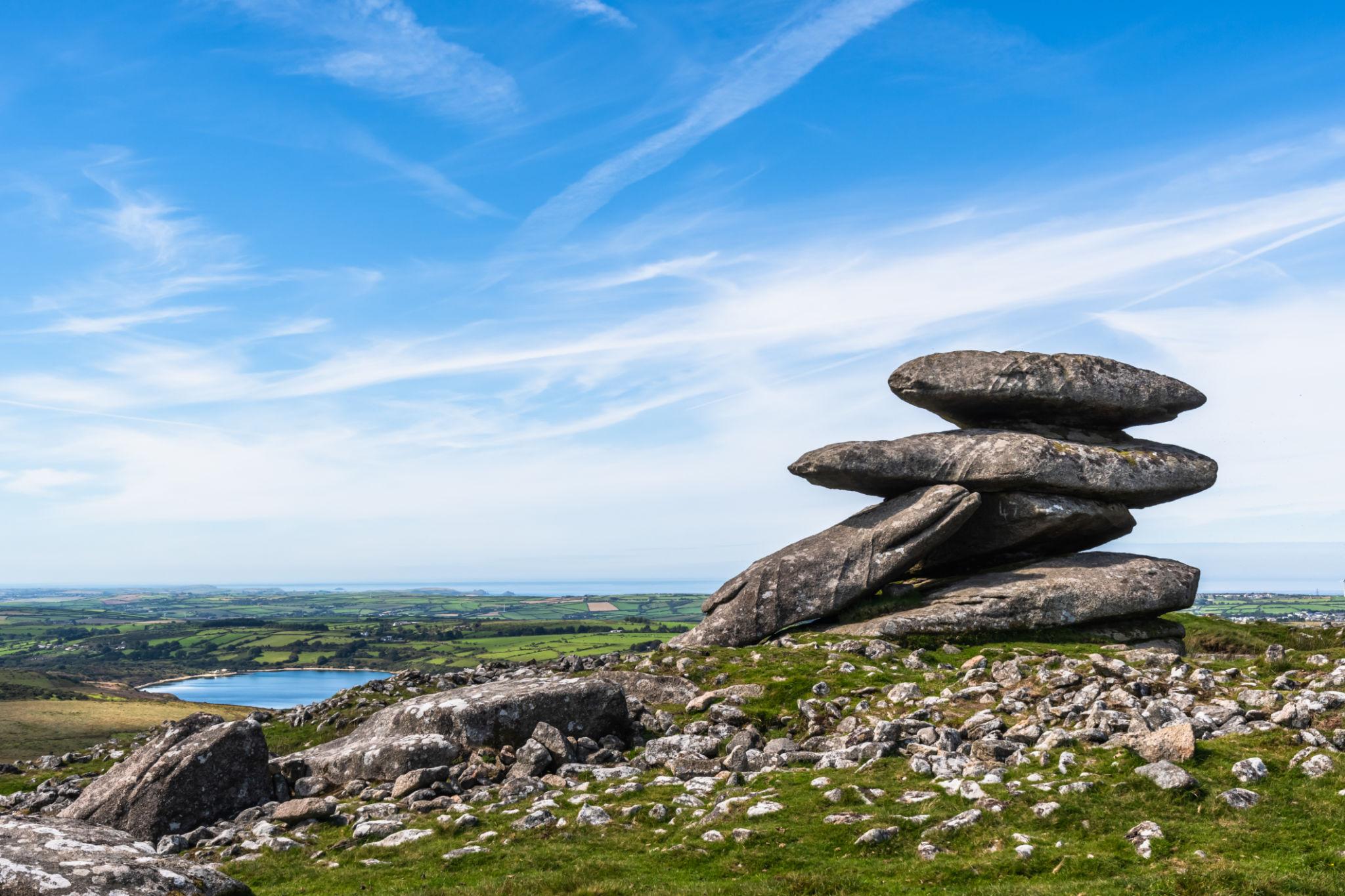
Rough Tor
Rough Tor – pronounced “row-ter”, rhyming with “outer” – is one of Bodmin Moor’s best-known granite summits and, at about 400 m, the second highest point in Cornwall after nearby Brown Willy. Its rugged outcrops rise above the surrounding moorland, showing how resistant granite can remain as the landscape around it is worn away.
The exposed slabs and blocks provide a striking illustration of the relationship between granite, joints and weathering.
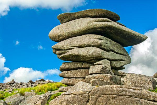
The Cheesewring
On Stowe’s Hill near Minions, on the south-eastern edge of Bodmin Moor, the Cheesewring is a natural granite tor of large slabs stacked in an apparently precarious formation, right at the edge of the old Cheesewring Quarry.
Its unusual shape demonstrates how granite can weather unevenly along joints, leaving resistant blocks exposed as surrounding material is removed. The Cheesewring is one of Cornwall's most recognisable geological landmarks.
A landscape shaped by weathering
The appearance of Bodmin Moor reflects the interaction between its underlying geology and the climate. Rain, frost, changes in temperature and the movement of water through fractures have gradually altered the exposed granite.
Freeze-thaw weathering can occur when water enters a crack, freezes and expands, helping to widen the fracture. Repeated over many cycles, this can loosen blocks from the rock mass. Chemical weathering also alters minerals, particularly along exposed surfaces and joints.
The resulting tors and boulder-strewn slopes are not simply piles of rocks. They are evidence of the long interaction between the original granite, the fractures within it and the processes that have shaped the moor since the granite was exposed at the surface.
Bodmin Moor granite at work
Bodmin Moor granite has been quarried for building stone for centuries. In the 19th century the Cheesewring quarries near Minions sent silver-grey granite down the Liskeard and Caradon Railway towards Liskeard and Looe for export, and granite boulders from the moor’s surface (moorstone) were shaped into gateposts, troughs and church walls across the area.
Granite is still worked at De Lank Quarry near St Breward, on the western side of the moor. De Lank stone was used for the fourth Eddystone Lighthouse, completed in 1882, and for buildings in London including the Royal Opera House and Portcullis House.
Exploring Bodmin Moor's geology
Rough Tor and the Cheesewring are excellent places to appreciate the character of Cornwall's granite landscape. Look for the large blocks, the cracks separating them, the exposed slabs and the boulders scattered across nearby slopes.
The Cheesewring is near Minions and can be visited as part of an exploration of the surrounding granite landscape and the nearby Hurlers stone circles. On the southern edge of the moor, granite boulders line the River Fowey at Golitha Falls near St Cleer. Rough Tor offers a different setting, with prominent granite outcrops standing above the open moorland.
Conditions on the moor can change quickly. Wear suitable footwear, take care on uneven and slippery rocks, check the weather before setting out and follow local access guidance. Keep to established paths where practical and leave the landscape undisturbed.
Further reading
- British Geological Survey: Trevose Head and Camelford geological memoir — detailed information about the Bodmin Moor granite.
- British Geological Survey: Geology Viewer — interactive bedrock map showing the granite and the rocks around it.
- English Nature: Natural Area geological profiles for South West England — includes Bodmin Moor, with its key geological features and sites.