Whitsand Bay
Four Wild Miles of Sand, Rock and High Cliffs on the Rame Peninsula
Whitsand Bay, Rame Peninsula, near Torpoint, Cornwall, PL11 3AL
Whitsand Bay is one of the biggest and wildest stretches of beach in Cornwall - a sweep of sand and rock running for roughly four miles along the south-west-facing coast of the Rame Peninsula, from the tip of Rame Head in the east to the small harbour village of Portwrinkle in the west. Seen from the coast road that runs high along the cliffs above, it looks less like a single beach than a whole coastline in miniature: a chain of named coves and sands - Polhawn, Tregantle, Sharrow, Freathy, Tregonhawke, Finnygook - that at low tide knit together into one vast strand, and at high tide separate again as the sea presses right up against the foot of the cliffs. It is a beach best approached with a little preparation and a lot of respect, because for all its scale and beauty, Whitsand Bay has a genuine and well-earned reputation as one of the more demanding beaches to visit safely in this part of Cornwall.
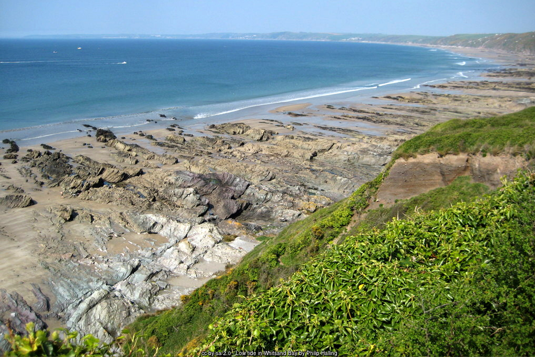
The drama of the place starts with the geology. Whitsand Bay is backed for its entire length by high, steep cliffs of Devonian slate and shale, part of the wider Rame Head and Whitsand Bay Site of Special Scientific Interest (SSSI), designated for both its geology and its biology - the cliff grasslands here support nationally scarce plants including early meadow-grass and slender bird's-foot-trefoil. Those same cliffs are unstable in places, prone to slippage and erosion, which is part of the reason every route down to the beach is a proper cliff path rather than a gentle stroll, and why the South West Coast Path that runs along the top stays well back from the edge in several stretches. It is a beach shaped as much by what happens on the cliffs above it as by the sea in front of it.
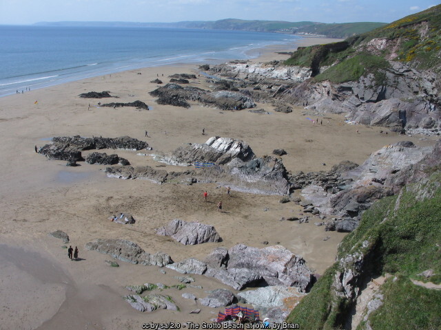
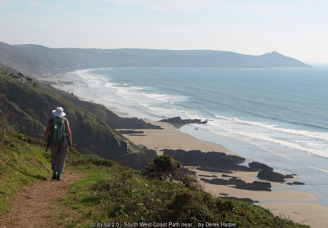
That instability, and the bay's exposed position guarding the western approaches to Plymouth, also explains the string of Victorian coastal forts that still stand above the sand. A Royal Commission on the nation's defences in 1859 identified this stretch as a weak point, and the Palmerston-era forts that followed still dominate the skyline today. Tregantle Fort, completed in 1865 above Long Sands at the bay's eastern end, remains in Ministry of Defence hands as an Army training area and firing range. Polhawn Battery, finished the previous year on the cliffs above Freathy, has since been converted into a private wedding and events venue. And Whitsand Bay Battery, completed in 1893 as the last of the three, is today the centrepiece of a holiday park. Below Freathy itself, a very different and much more recent kind of settlement has grown up on the cliff face: a scatter of individual timber holiday chalets, built up piecemeal from the 1920s and 1930s onwards, that has given this stretch of coast its enduring local nickname of "the Chalet Coast".
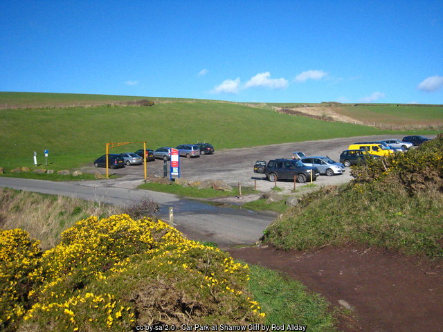
Getting down onto the sand from any of these clifftop settlements is, frankly, part of the challenge of visiting Whitsand Bay. There is no single beach access point; instead a handful of car parks are strung out along the coast road, each linked to the beach below by its own steep, narrow and often slippery cliff path, typically including one or more flights of steps. Cornwall Council's car park at Tregantle (Torpoint, PL11 3AL) serves Long Sands beneath the fort; further along, Sharrow has what is generally reckoned the easiest of the bay's access paths, along with reasonable clifftop parking; Freathy's car park serves the chalet-lined path down past Polhawn; and Tregonhawke, roughly in the centre of the bay, has a mix of roadside and seasonal field parking that fills quickly on a sunny day. None of these paths is suitable for wheelchairs or pushchairs, and even fit, able-bodied visitors should expect the climb back up - particularly with children, dogs, or a beach bag full of wet kit - to feel considerably harder than the walk down.
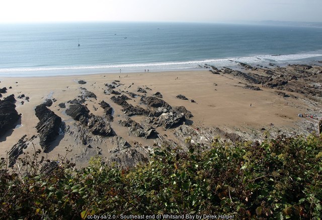
The tide is the other, more serious part of that challenge, and it deserves to be taken seriously. At low water Whitsand Bay opens out into a huge expanse of sand that makes the various coves feel like one continuous beach, but as the tide comes in the sea can reach right up to the base of the cliffs in a number of places, cutting off stretches of sand beneath the access paths and, in the wrong conditions, trapping anyone still down there. Rip currents and shifting sandbars add a further hazard in the water itself. This is not a theoretical risk: the RNLI has been called out repeatedly over the years to rescue people, and on occasion dogs, cut off by a rising tide here, and in April 2026 RNLI lifeguards and Looe's lifeboat crew responded together to multiple casualties caught in rip currents off Tregantle beach. It is worth being clear about exactly where lifeguard cover exists, because it is limited: RNLI lifeguards patrol only Tregonhawke beach, daily from 2 May to 27 September 2026 (plus Easter and October half-term weekends), with patrol hours of 10am to 6pm. Tregantle, Sharrow, Freathy, Polhawn and every other part of this four-mile bay have no lifeguard cover at any time of year, and the RNLI's own rule applies wherever you are on the bay: no flags means no lifeguards. Checking tide times before you go, and leaving good time to get back up the cliff before the tide turns, genuinely matters at Whitsand Bay in a way it does not at every Cornish beach - this is one of the more hazardous stretches of coast in Cornwall for anyone who treats it casually, and it deserves to be taken seriously rather than talked up for effect.
At the eastern end of the bay, Tregantle beach sits beside a firing range that is still very much in active military use, and this adds a further layer to the safety picture here. Current firing times for the Tregantle ranges are published monthly on GOV.UK, and the guidance is unambiguous: whatever the published schedule says, if red flags or lights are hoisted at the range, the danger area must not be entered under any circumstances, as it represents a genuine danger to life. It is worth checking the current firing notice before planning a visit to this end of the bay, and always treating a flying red flag as the final word regardless of what any timetable suggests.
Given all of that, it might be a surprise that Whitsand Bay is also one of the more popular surfing beaches in South East Cornwall - but its south-west-facing, fully open aspect means it picks up plenty of Atlantic swell, with dependable beach-break waves that tend to work best around Tregantle and Tregonhawke from mid to low tide. Adventure Bay Surf School, based on the bay, runs surf lessons and coasteering sessions for beginners and improvers alike, making the most of the same wild, exposed setting that makes the rest of the beach worth treating with care. Divers, meanwhile, are drawn a little further offshore, where three well-known wrecks lie within reach: HMS Scylla, a decommissioned Royal Navy frigate deliberately sunk in 2004 as an artificial reef; the James Eagan Layne, a Second World War Liberty ship torpedoed in 1945; and HMS A7, a submarine lost in 1914 and now protected as a historic wreck site.
Facilities around the bay are, in keeping with its wild character, fairly sparse and concentrated at one or two points rather than spread evenly along its length. The most reliable cluster is at Tregonhawke, where public toilets and the Cliff Top Café sit at the top of the beach access, with the Fort Inn nearby for a more substantial meal; elsewhere along the bay, visitors should expect to bring what they need, since car parks at Tregantle, Sharrow and Freathy have little or nothing in the way of facilities beyond parking itself. Dogs are welcome on Whitsand Bay all year round, with no seasonal restriction of the kind seen on many of Cornwall's more built-up town beaches - one more reason, alongside the surf, the space and the sheer scale of the place, that Whitsand Bay keeps drawing visitors back, provided they treat its tides, its cliffs and its military neighbour with the caution they deserve.
Visitor Information
Parking
There is no single car park for Whitsand Bay. Separate clifftop car parks serve Tregantle (Cornwall Council, Torpoint, PL11 3AL), Sharrow, Freathy and Tregonhawke, each linked to the beach by its own steep cliff path. Tregonhawke's mix of roadside and seasonal field parking fills quickly on sunny days.
Facilities
Facilities are limited and concentrated at Tregonhawke, where public toilets and the Cliff Top Café sit at the top of the beach access, with the Fort Inn nearby. Elsewhere along the bay expect little beyond parking, so bring what you need. RNLI lifeguards patrol Tregonhawke only, daily from 2 May to 27 September 2026, 10am-6pm.
Disabled Access
Whitsand Bay is not realistically accessible for wheelchair or pushchair users. Every route down - at Tregantle, Sharrow, Freathy and Tregonhawke - is a steep, uneven cliff path with flights of steps, and there is no surfaced or level way onto the sand. Blue Badge holders can use the clifftop car parks, but the beach itself lies well below them.
Things to Do Nearby
- RNLI Tregonhawke Beach, official lifeguard patrol times, flag meanings and safety advice for the only lifeguarded part of Whitsand Bay
- Tregantle Beach, the beach and Victorian fort at the bay's eastern end, with its own full visitor guide
- Adventure Bay Surf School, offering surf lessons and coasteering on Whitsand Bay for beginners and improvers
- Wreck diving offshore to HMS Scylla, the James Eagan Layne and the submarine HMS A7, three well-known dive sites close to the bay
- Portwrinkle, the small harbour village and beach at the western end of Whitsand Bay
- Kingsand & Cawsand, the twin villages and beaches at the bay's eastern end, beyond Rame Head
- Downderry, a sandy beach a little further east towards Looe
- Tregantle Fort and the Rame Peninsula forts, the chain of Victorian coastal defences above the bay, including Polhawn Battery (now a wedding venue) and Whitsand Bay Battery
Places to Stay
Frequently Asked Questions
Page last updated: 15 September 2026.