Wherrytown Beach
A Tidal Pebble Shore with a Sunken Mine and a Buried Forest
Wherrytown Beach, Penzance, Cornwall, TR18 4NX
Wherrytown is the westernmost of Penzance's string of seafront beaches, occupying the stretch of shore between Newlyn and Penzance town centre on the east side of the mouth of the Laregan River. It is a quieter, more workaday spot than the promenade beach further along the bay, and a large pebble beach rather than a sandy one - a long bank of shingle and stone that shelves down towards the sea and is fully covered at high water. The South West Coast Path runs along the top of the beach here, part of the continuous walking route that links Penzance to Newlyn and on round to Mousehole and Lamorna, so Wherrytown tends to be seen by as many walkers passing through as by people stopping to spend the day on the stones themselves.
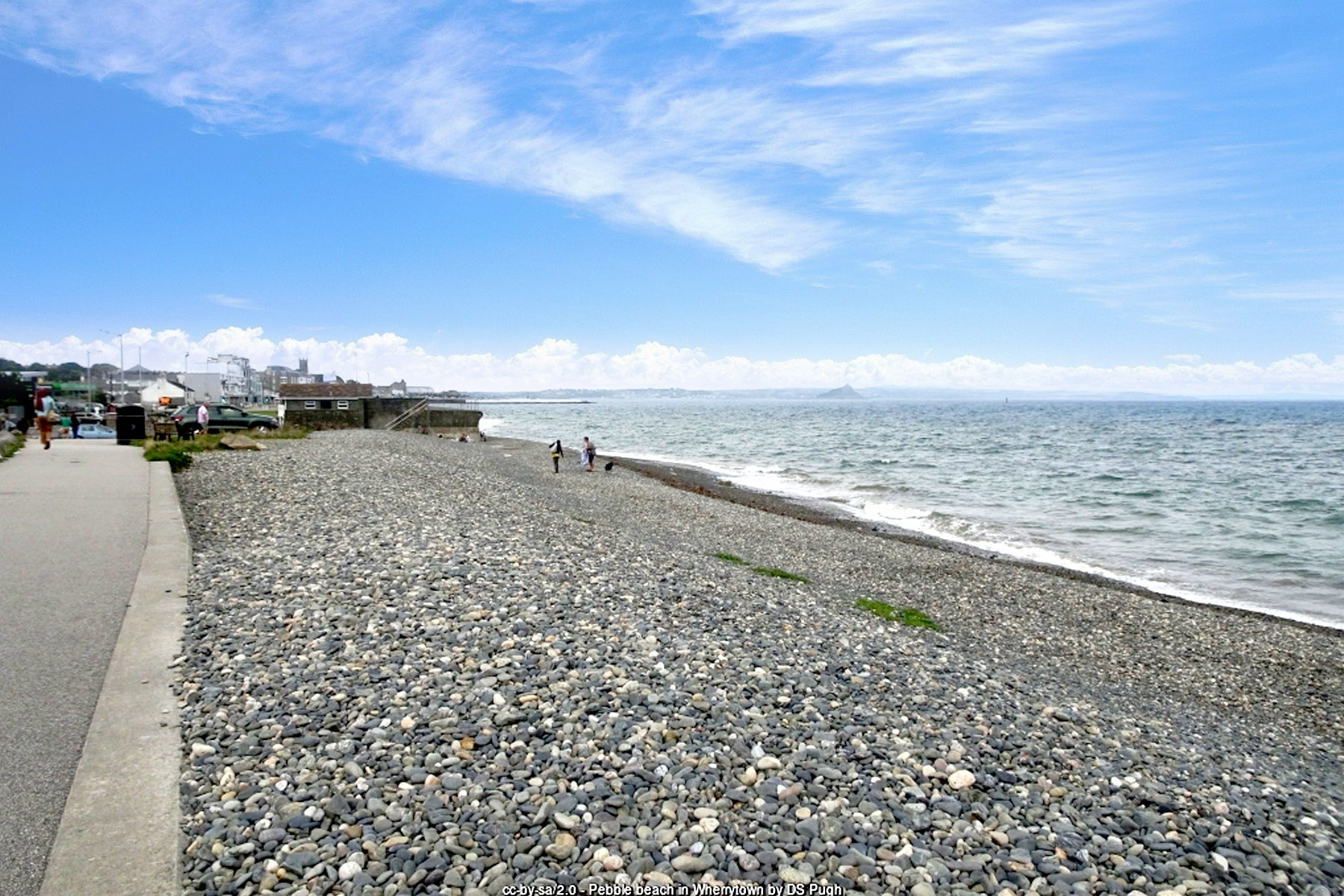
What sets Wherrytown apart from most Cornish beaches, sand or shingle, is what sometimes appears on the foreshore at very low tide. Mount's Bay sits above the remains of an ancient forest that once covered this part of the coastline before rising sea levels drowned it, and low spring tides can expose peat beds, tree stumps and root systems, along with occasional fragments of fossilised or part-mineralised wood, dating back an estimated four to six thousand years. The best-documented exposures of this submerged forest tend to appear a little further along the bay towards Chyandour, near the causeway to St Michael's Mount, but the same drowned woodland extended across the floor of Mount's Bay, and stumps and blackened wood have also been recorded on the Wherrytown foreshore when conditions are right. Sightings are rare - the stumps have only been visible a handful of times in the past decade or so, on the very lowest tides of the year - which makes the beach a genuinely interesting spot for anyone curious about the deep prehistory hidden beneath an apparently ordinary stretch of shingle. It is worth noting that St Michael's Mount's old Cornish name, Karrek Loos yn Koos, means "grey rock in the wood" - a name that only makes sense if the Mount was once surrounded by trees rather than sea, and a strong hint that this drowned landscape has been part of local memory for a very long time.
Wherrytown's more recent history is dominated by one of the strangest mining ventures ever attempted in Cornwall. In 1778, a local man named Thomas Curtis sank a shaft on the beach itself, below the level of the high tide, to work a rich tin lode that ran out under the sea. Because the workings lay beneath the seabed, they had to be protected from the water above by iron funnels and shafts rising clear of high tide, and miners working underground reported hearing the sea roaring over their heads as the tide came in and out - a detail that has stuck in local retelling of the mine's history ever since. It was one of only a handful of genuinely sub-sea mines ever worked in Cornwall, and for a time it was a serious commercial concern: the mine is recorded as having produced tin ore worth around £70,000, along with cobalt extracted before 1816, figures that made it one of the more lucrative small mines of its era. In September 1792 the scientist Davies Gilbert inspected the workings and wrote optimistically that the mine "promises to make a very great mine," believing the tin lode continued a great distance in both directions beneath the bay.
The Wherry Mine's main phase of working ceased in 1798, reportedly after storm damage to the shaft and its protective bridgework, in one account following a collision with a passing vessel. That was not quite the end of the story: the site attracted renewed interest on several later occasions, with reopening attempts recorded in 1823 and again in the 1830s, when a new company installed a substantial engine onshore before operations petered out around 1840, and a final, short-lived attempt in 1967 saw a temporary quay built out at the Laregan rocks. None of these later ventures matched the original run, and the Wherry Mine today survives mainly as a remarkable footnote in Cornish mining history - a mine that was, quite literally, dug out from under the sea, in a landscape now occupied by a quiet pebble beach and a coast path rather than any visible headworks.
After mining wound down, Wherrytown reinvented itself as a centre for working Cornwall's other well-known stone: serpentine, the mottled greenish rock quarried on the Lizard peninsula and prized for ornamental carving. Three Penzance businessmen, John Bromley, Richard Millet and John Organ, set up serpentine works on the old mine site, cutting and polishing the stone into vases, obelisks, fonts and other decorative pieces. Their big break came in 1846, when Prince Albert and the royal family toured the works during a visit to Cornwall, an endorsement that led directly to commissions for Osborne House, the royal family's own residence on the Isle of Wight, and did wonders for the reputation of the London and Penzance Serpentine Company that grew out of the venture. John Organ's work was good enough to win prizes at the Great Exhibition of 1851 in London, the landmark international showcase held in the Crystal Palace, where his carved serpentine obelisks and a font were singled out for recognition - a striking achievement for a small West Cornwall workshop built on the site of a defunct sub-sea tin mine. The company's fortunes eventually turned: rival serpentine works at Poltesco on the Lizard undercut Wherrytown's operation, and the London and Penzance Serpentine Company closed for good in 1865.
Stone working at Wherrytown did not end there. In 1883 the firm of Freeman and Sons ran a granite yard on the site employing around nineteen men, dressing granite brought in from quarries at Lamorna, New Mill and Sheffield (the Cornish hamlet near Penzance, not the English city) for use in the construction of Penzance's new harbour works. Timber mills and a flour mill also operated in the settlement during the nineteenth century, making Wherrytown, for a time, a genuinely industrious little corner of the Penzance shoreline rather than the quiet residential and recreational stretch it is today. Administratively, Wherrytown was originally part of the ancient parish of Madron, only becoming part of the Borough of Penzance in 1934 as the town's boundaries were redrawn.
Wherrytown's built history was largely erased in a single night. On 7 March 1962, the Ash Wednesday storm - a severe easterly gale that battered much of the Cornish coast - devastated the settlement, destroying almost every building along nearly a mile of seafront between Battery Rocks and Tolcarne. The only Wherrytown building recorded as having survived the storm was the Mount's Bay Inn, which still stands today as one of the few physical links to the settlement's older character, a solitary survivor amid what is now a mostly residential and recreational stretch of shoreline.
For visitors today, Wherrytown functions mainly as a starting or finishing point for a coast path walk, a place for a quiet pebble-beach stroll at low tide, and - for the fortunate few who time a visit to coincide with an exceptionally low spring tide - a chance to glimpse a landscape that has otherwise been underwater for thousands of years. There are no facilities directly on the beach itself, so it suits a short, self-contained visit rather than a full day out with children in tow, though the wider Penzance seafront a short walk to the east offers cafés, restaurants and all the usual amenities of a working Cornish town.
Because the beach is shingle rather than sand and slopes down into deeper water reasonably quickly, Wherrytown is used more for walking, dog exercise and rockpooling around its margins than for sunbathing or swimming, though the sea here is part of the same water quality zone as the rest of the Penzance seafront, rated "Good" under current bathing water standards. Seasonal lifeguard cover operates nearby on the main Penzance beaches during the peak summer season, though cover directly at Wherrytown itself should not be assumed outside those patrolled areas, and swimmers should take the tide and the shelving shingle into account before going in. As with the rest of this stretch of coast, conditions can change quickly with the weather, and the exposed, west-facing position towards Mount's Bay means a bigger swell here is not unusual even when the town beaches further along stay comparatively calm.
Visitor Information
Parking
Three car parks lie within easy reach of Wherrytown, together offering around 600 spaces, making this one of the better-served beaches for parking along the whole Penzance seafront.
Facilities
There are no facilities directly on the beach itself, but public toilets and a range of cafés and restaurants are within a short walk along the surrounding Penzance seafront.
Disabled Access
The shingle surface of the beach itself is uneven underfoot, though the adjoining coast path and seafront are level. Toilets with disabled access are available nearby at Penzance (Longrock), and disabled parking bays are included among the roughly 600 spaces across the three nearby car parks.
Things to Do Nearby
- Penzance Promenade Beach, the town's main flagship beach, a short walk east
- Battery Rocks, below Penzance harbour beside Jubilee Pool
- Eastern Green, curving east from Station Rocks
- Long Rock, the easternmost beach towards Marazion
- Mousehole, a picturesque fishing village with its own small harbour beach, a few miles west via Newlyn
- Penlee House Gallery & Museum, Morrab Road, Penzance
Places to Stay
Frequently Asked Questions
Page last updated: 11 September 2026.