Mawgan Porth
A Dark Age Village Under the Dunes, and Consistent Atlantic Surf
Mawgan Porth, near Padstow, Cornwall, TR8 4BA
Mawgan Porth is a broad, dune-backed beach on the north Cornwall coast, sitting roughly midway along the stretch of coastline that runs from Padstow in the north down to Newquay some four miles to the south, and grouped here among the Padstow beaches even though many visitors reach it just as readily from Newquay. It occupies the seaward end of the Vale of Mawgan, a green, steep-sided valley that carries the small River Menalhyl down from the parish of St Mawgan-in-Pydar to the coast, and the little settlement that has grown up around the beach - a pub, a general store, a handful of hotels and guest houses, and three long-established holiday parks in Magic Cove, Cosy Corner and Sun Haven Valley - has a quieter, more residential character than the bigger resorts nearby, even at the height of summer. What draws people back to it, though, is the combination on offer in a fairly compact space: a genuinely good, dependable surf beach, sand and rock pools enough to occupy a family for a full day, and, hidden in the dunes above the beach itself, one of the most important early medieval archaeological sites ever excavated in Cornwall.
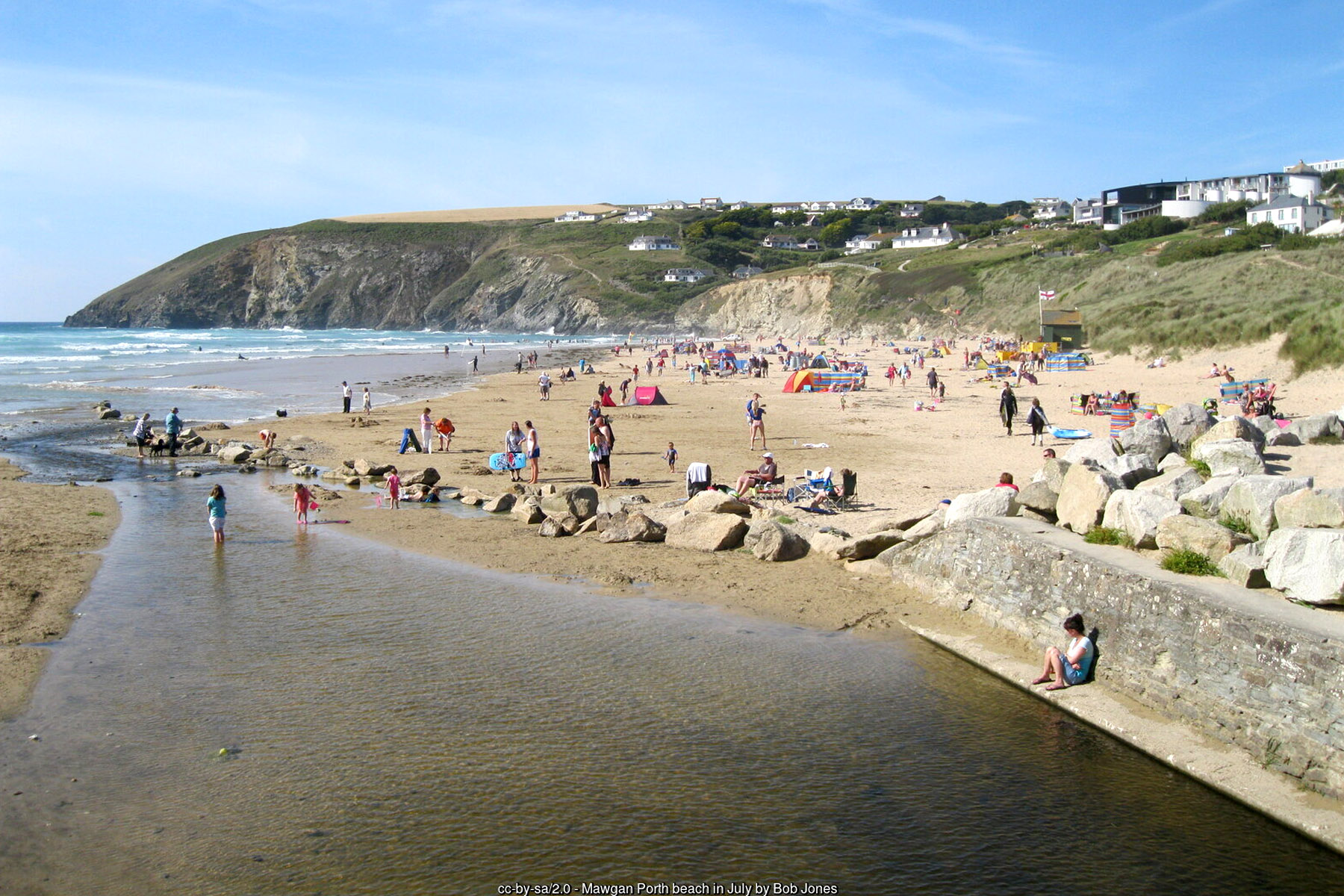
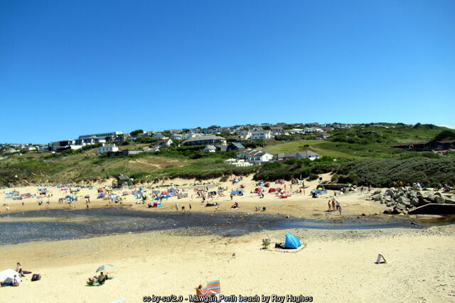
The beach itself is a wide, gently curving sweep of sand, sheltered by cliffs at both the northern and southern ends and backed along most of its length by a substantial dune system rather than the low sea wall or promenade found at some neighbouring resorts. At low tide there is a very generous expanse of firm, flat sand, more than enough for even the busiest of summer days, narrowing back towards the dunes as the tide comes in; the South West Coast Path runs along the clifftop directly behind the beach, giving walkers a clear line north towards Bedruthan Steps and south towards Watergate Bay and Newquay. The River Menalhyl, having wound its way down through the wooded Vale of Mawgan past the village of St Mawgan, crosses the sand on the southern side of the beach as a shallow stream before reaching the sea - a genuinely attractive feature for children to dam and paddle in, though one that also means the very edge of the stream channel is worth a little extra care with young children at the water's edge. Rock pools and a scatter of small caves are exposed among the rocks at each end of the beach as the tide drops, rewarding anyone willing to explore a little beyond the main stretch of open sand.
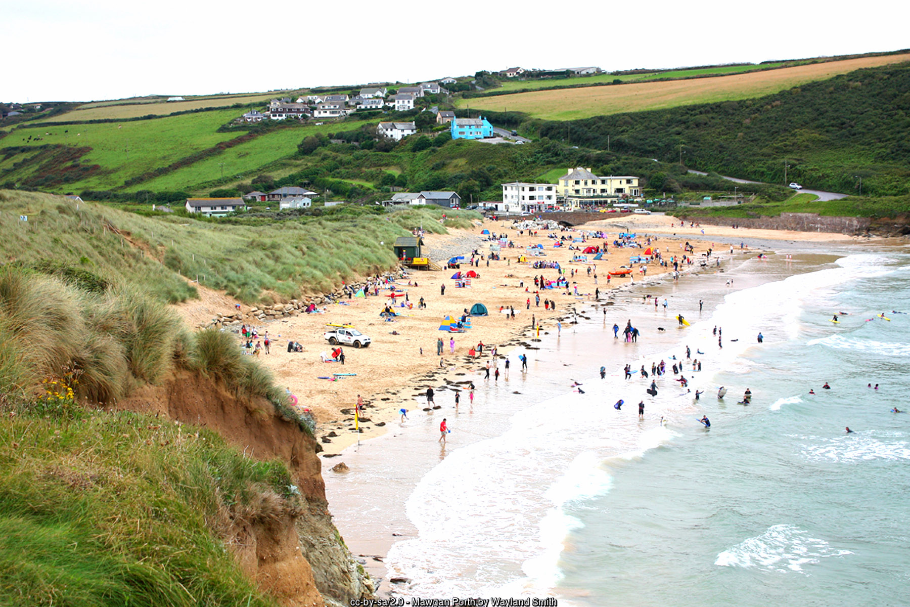
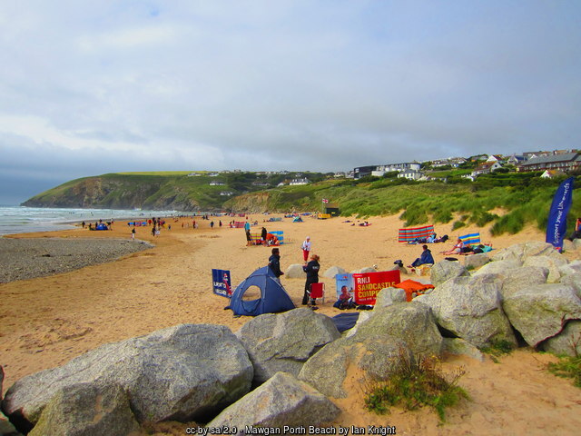
That exposure to the open Atlantic is what makes Mawgan Porth as good a surfing beach as it is a family one. Breakers here are generally more forgiving and more consistent than the harder-hitting reef and point breaks elsewhere on this coast, which has long made the beach a favourite for what an older generation of guidebooks still fondly describe as "Malibu boards" - the longboards of their day - as well as for bodyboarders and, in more recent years, for the steady stream of beginner and improver surf lessons run here by local surf schools through the season. The beach faces almost due west and works across a good range of swell and tide states, so it rarely goes entirely flat, though like any open Atlantic beach it can also turn choppy, wind-affected or genuinely powerful when a big swell is running, and conditions are always worth checking locally before paddling out. RNLI lifeguards patrol Mawgan Porth on a seasonal basis - in recent years running from the Easter holidays through to late October, with a full daily service from early May to late September and weekend-only cover either side of that, generally between 10am and 6pm - and, as everywhere, the advice is straightforward: swim or bodyboard only between the red and yellow flags when they are flying, and treat "no flags" as "no lifeguards" rather than as a beach that has simply gone quiet.
It is what lies beneath the dunes above the beach, however, that gives Mawgan Porth its real claim to fame beyond the sand and the surf. A skeleton found here by chance in 1934, followed by a further trial excavation in 1948 that turned up a coin of King Æthelred II dated to around 990-995, was enough to convince the Ministry of Works to mount a full-scale excavation of the site, carried out between 1950 and 1954 under the direction of the archaeologist Rupert Bruce-Mitford, with Paul Ashbee and Ernest Greenfield among the team, and followed by a further season of work in 1974. What they uncovered was a small but remarkably well-preserved Dark Age farming settlement, generally dated to somewhere between about AD 850 and 1050 - the late Saxon period, though this was very much still independent, Brythonic-speaking Cornwall rather than Wessex. At least four farmstead complexes were identified, arranged around cut platforms and courtyards on the sloping ground, their walls built of dry stone standing in places over two metres high; at least one building was a longhouse of a type well known from elsewhere in the Atlantic west, combining living quarters and a cattle byre under a single roof. Alongside the farmsteads the excavators found a cemetery of around fifty burials - a little over twenty of them actually dug, the remainder identified but left in the ground - laid out mostly east to west in simple coffins or stone-lined graves, with a notably high proportion of children among the dead. Distinctive locally made pottery, related to wares found across Cornwall and the Isles of Scilly in the period, was recovered in quantity and is now held partly by the British Museum. In the end the settlement seems to have been abandoned not through violence or plague but through the sheer, patient pressure of wind-blown sand off the dunes, which gradually buried the houses and was never cleared; because nothing was built over the site afterwards, the buildings survived remarkably intact to be excavated nearly a thousand years later. The site is now protected as a Scheduled Monument and stands as one of the most important and complete windows we have onto everyday rural life in early medieval Cornwall, a period for which written evidence from the county is otherwise extremely thin.
Above the beach, the village itself keeps things simple: a well-regarded pub, a general store for essentials, a scattering of hotels and guest houses, and three holiday parks of very different vintages - Magic Cove, the oldest of the three, Cosy Corner, closest to the beach itself, and the larger Sun Haven Valley set back up the valley - between them accounting for a good deal of Mawgan Porth's visitor accommodation. The village had an unexpectedly cosmopolitan interlude in the years before the Second World War, when the German sculptor Faust Lang lived and worked here between 1936 and 1949, a detail that still surprises visitors who assume this stretch of coast has always been purely a farming and fishing landscape. Today the appeal is more straightforward: a genuinely good, exposed Atlantic beach with dependable surf, a car park close enough to the sand that it barely counts as a walk, dogs welcome on the beach in every month of the year rather than only outside a summer ban, and, for anyone willing to look a little further than the tideline, one of the most significant Dark Age archaeological sites anywhere in the county sitting quietly in the dunes behind it.
Visitor Information
Parking
A car park sits directly across the coast road from the beach (TR8 4BA), giving genuinely short, level, disabled-friendly access down onto the sand. It gets busy quickly in peak season and can fill by mid-morning on the sunniest summer days, so arriving early is worthwhile.
Facilities
Public toilets stand close to the car park. The village has a pub, a general store, cafes and a small choice of places to eat, along with hotels, guest houses and holiday parks all within a short walk of the beach.
Disabled Access
Genuinely short, level access from the car park directly opposite the beach, among the more accessible beaches in the area for wheelchairs and pushchairs. No dedicated Blue Badge bays are confirmed – check locally before you travel.
Things to Do Nearby
- Visiting the site of the Mawgan Porth Dark Age settlement, a Scheduled Monument in the dunes above the beach and one of Cornwall's most important early medieval archaeological finds
- Surf lessons and hire with the local surf schools that run beginner and improver sessions on the beach through the season
- Walking the South West Coast Path north to Carnewas at Bedruthan (Bedruthan Steps), the National Trust's dramatic clifftop and sea-stack site a short distance up the coast
- Porthcothan Bay, a quieter sandy beach a little further north along the coast towards Padstow
- Rock pooling and cave exploring among the rocks at each end of the beach at low tide
- Reading more about the archaeology of the site via Historic England's Scheduled Monument listing
- Checking seasonal lifeguard dates and beach safety advice on the RNLI's Mawgan Porth beach page
Places to Stay
Mawgan Porth has a good range of its own holiday accommodation, from hotels and guest houses close to the beach to self-catering cottages and apartments in and around the village:
Frequently Asked Questions
Page last updated: 15 September 2026.