Mexico Towans
A Dune-Backed Stretch of St Ives Bay, Dog-Friendly All Year
Mexico Towans, Hayle, Cornwall, TR27 5AF
Mexico Towans is one of the best-loved access points along Hayle's celebrated three-mile beach, the long run of golden sand and dune that curves round St Ives Bay from the mouth of the Hayle Estuary to Godrevy Point. Tucked between Upton Towans to the north-east and Hayle Towans (and Riviere Towans beyond it) to the south-west, it has its own dedicated car park and a distinct local identity, even though the sand itself runs on, largely unbroken, in both directions at low tide. Visit Cornwall and most other beach guides list it as a named beach in its own right, and locals and regular visitors know it simply as "Mexico" - a broad, open, dune-backed stretch that is popular with families, dog walkers and watersports enthusiasts, and noticeably quieter than the busier beaches closer to St Ives and Hayle harbour.
The name is one of the more intriguing on this coastline, and its exact origin is not fully settled. Historic England's listing for the nearby Mexico Cross - a scheduled medieval wayside granite cross that once marked the old route across the dunes from Gwithian church to the Hayle Estuary crossing at Lelant - records that a smallholding called "Mexico" already existed on this ground by 1842, without explaining why. Local tradition, repeated in several Cornish mining-heritage accounts, links it instead to the men of Hayle and Phillack who travelled out to work the silver mines around Real del Monte and Pachuca in Mexico during the great wave of Cornish emigration of the 1820s and 1830s, and came home again - the name supposedly commemorating those who had "failed to settle out there" and returned to farm or mine locally. The same cluster of names survives nearby: Mexico Lane and Mexico Close run through Phillack today, and old mine plans mark a "Mexico" working close to the historic Wheal Alfred sett east of Hayle. Whichever version is closer to the truth, the name is a genuine and long-standing piece of local history rather than a modern invention, and a small reminder of how far Cornwall's 19th-century mining diaspora reached.
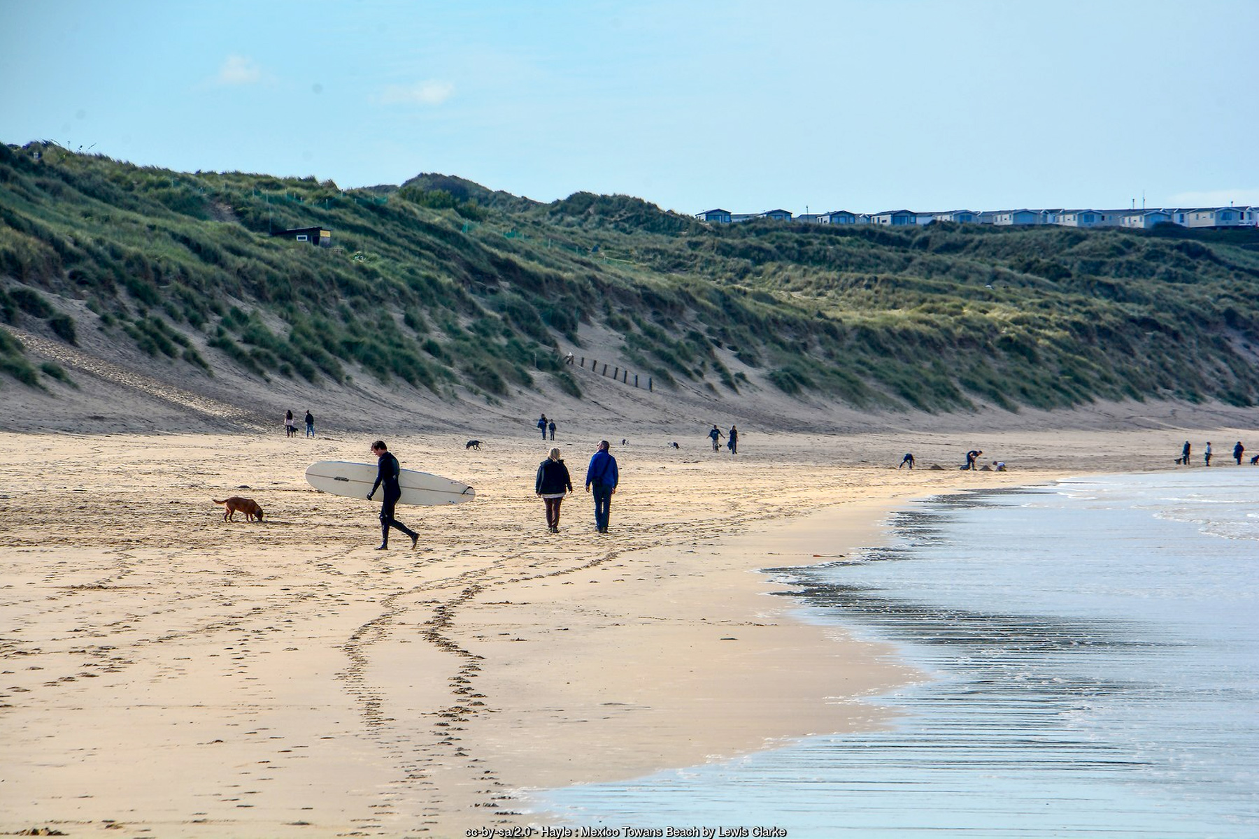
Geographically, Mexico Towans is simply a section of the wider beach rather than a separate cove: a broad, gently shelving expanse of pale sand that runs for well over a mile at low tide, backed the whole way by a high wall of dunes rising in places to well over 30 metres. At low water the sand is vast enough to lose a crowd in, with plenty of space between the tideline and the foot of the dunes; as the tide rises, that margin narrows quickly, and at the very top of a big spring tide the beach can be reduced to a fairly slim strip, so it pays to check the tide table rather than assume the same generous width will still be there in a few hours. The dunes themselves are steep and, in places, unstable underfoot, cut through by a scatter of informal sandy paths down from the car park rather than a single formal access route.
A car park sits back from the beach behind the dunes - known locally, along with the stretch of sand and dunes it serves, as Sandy Acres - with a small independent café said to operate out of a converted shipping container, serving coffee, cake and the sort of thing that's welcome after a cold swim or a surf lesson. Beyond that, facilities right at Mexico Towans itself are minimal: there are no public toilets and no shop directly on this stretch, and anyone wanting more - toilets, a wider choice of food, or a pint - needs to walk or drive the short distance south-west to Riviere Towans and Hayle Towans, or further round towards Hayle town and Phillack. That relative lack of infrastructure is, for many regular visitors, part of the appeal: this is a quieter, more low-key stretch of the bay than the busier beaches nearer St Ives.
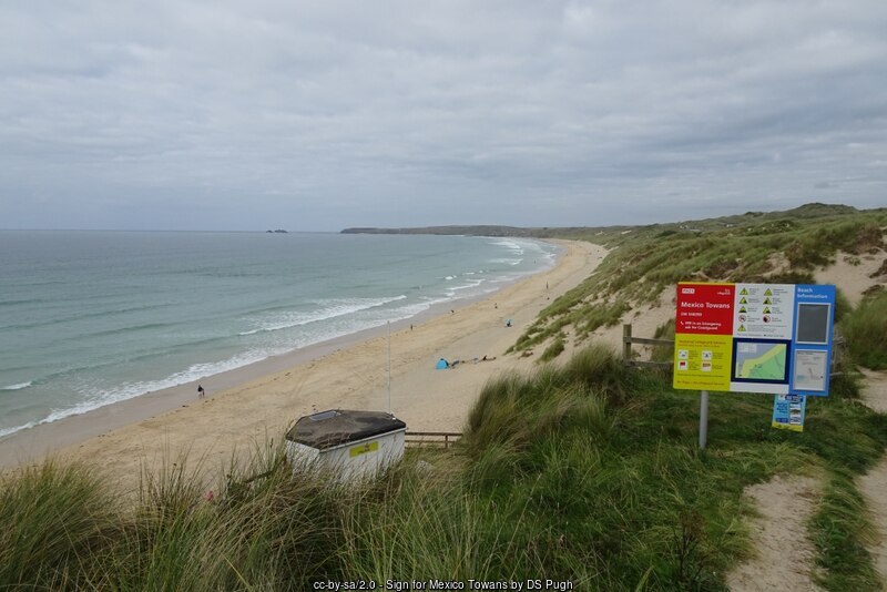
Dogs are allowed at Mexico Towans all year round, which sets it apart from several neighbouring sections of the same beach - Harveys Towans and the stretch on towards Black Cliff, to the south-west, carry a seasonal dog ban through the summer months, and the northern end of the system towards Gwithian has its own seasonal restrictions too. There are no fences or formal markers between these zones - the change is signed rather than fenced - so owners walking a long stretch of the beach should watch for signage as they move between sections rather than assume the Mexico Towans rules apply everywhere.
Mexico Towans does not have its own RNLI lifeguard station, and it sits in something of a gap between the two nearest patrolled beaches: Hayle Towans to the south-west and Gwithian North/Godrevy to the north-east both carry seasonal RNLI cover through the main season, broadly early May to late September, 10am to 6pm, on the usual "no flags, no lifeguards" basis - but the central stretch around Mexico Towans itself is generally unpatrolled. That matters because this whole bay is a fully exposed, Atlantic-facing beach with a real risk of rip currents, particularly around any low-tide sandbank or gully, and a beach break that can produce a heavy, dumping shorebreak at low water. Anyone wanting supervised swimming should walk to one of the flagged sections rather than assume cover extends along the whole three miles, and everybody should treat the currents here with the same respect as anywhere else on this coast.
What Mexico Towans lacks in lifeguard cover, it makes up for as a watersports launch point: this stretch, together with the Sandy Acres car park behind it, is a well-known kitesurfing and wave-sailing spot, working best in a west-south-westerly wind through to a northerly, with rideable conditions across a wide arc of the compass thanks to the open sweep of St Ives Bay. Conditions get progressively more powerful moving north-east towards Gwithian and Upton Towans, so Mexico Towans is often used as a slightly gentler middle ground between the flatter, more sheltered water off Hayle's harbour side and the fuller-on swell further along the bay - though a strong downwind rip and, at low tide, a genuinely heavy close-out shorebreak both demand real caution and plenty of power in hand. Surfers and bodyboarders find fun, peaky, fairly forgiving waves here too, generally reckoned to suit intermediates best, and local surf schools run lessons along this section of coast in season.
The dunes behind the beach are part of the Gwithian to Mexico Towans Site of Special Scientific Interest, a designation recognising this as one of the most important dune systems in Cornwall - by some counts the second largest in the county, spread across several hundred hectares of the wider Towans and supporting somewhere in the region of 300 recorded plant species. Marram grass binds the actively mobile fore-dunes nearest the beach, giving way further back to a patchwork of more fixed, species-rich dune grassland and scrub where plants such as sea holly, evening primrose, restharrow and various orchids can be found in season. Adders are a genuine, if easily overlooked, resident of the drier dune slopes and are occasionally seen basking on warm days - walkers and dogs are best kept to the paths rather than pushing through the marram - while skylarks nest in the open grassland, and the whole system supports a range of invertebrates that specialise in loose, sun-warmed sand found in few other places in Cornwall.
The wider Towans carry a longer working history than their present quiet, recreational character suggests. Tin streaming took place around Gwithian from early times, and the dunes further north and east - inland from Mexico Towans, around Upton and Gwithian Towans - were extensively reshaped in the late 19th and early 20th centuries by large-scale sand and gravel extraction and by the National Explosives Company, whose works there between 1888 and 1920 gave that section its old nickname of "Dynamite Towans"; blast banks and other structures from that period can still be picked out in the dune landscape today. Mexico Towans itself sits closer to the older mining ground around Phillack and the historic Wheal Alfred sett - now itself a Site of Special Scientific Interest in its own right, valued by geologists for its mineral specimens - a reminder that this whole stretch of coast, for all its present-day calm, was industrial territory within relatively recent memory of Cornwall's mining boom.
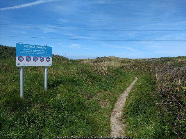
The South West Coast Path runs along the top of the dunes above the beach, linking Mexico Towans on foot to Upton Towans and Gwithian in one direction and to Riviere Towans, Hayle Towans and the mouth of the Hayle Estuary - an RSPB reserve important for wading birds and wildfowl - in the other. Views up the bay take in Godrevy Island and its lighthouse, built in 1858 and famous as the inspiration for Virginia Woolf's To the Lighthouse, while looking the other way the coast curves round towards St Ives itself. Low tide, when the beach is at its widest and the connecting sands to neighbouring Towans are fully open, is generally the best time to explore on foot or to try rockpooling among the rockier sections further along the shore; a rising tide can cut off a longer walk far more quickly than it looks, so it is worth starting out with the tide times in mind rather than working them out as you go.
Visitor Information
Parking
A car park known locally as Sandy Acres sits behind the dunes, reached off the coast lane between Hayle and Gwithian, with sandy paths down to the beach. It's a fairly informal, unsurfaced car park rather than a large managed one, and can fill on a good day.
Facilities
A small independent café operates at the car park. There are no public toilets or shops directly at the beach - the nearest are at Hayle/Riviere Towans or in Hayle town. No permanent lifeguard station; nearest seasonal RNLI patrols are at Hayle Towans and Gwithian North/Godrevy.
Disabled Access
Access from the car park is via steep, sandy dune paths rather than a level or boarded route, and is not considered suitable for wheelchairs or pushchairs. There are no marked Blue Badge bays at the Sandy Acres car park.
Things to Do Nearby
- Upton Towans, the next section of dune-backed beach to the north-east
- Hayle Towans, a short walk south-west, with more facilities close by
- Godrevy, further round the bay, with its headland, lighthouse and coastal views
- Hayle Town Guide - shops, the estuary and the town's industrial heritage
- Windsurfing in Cornwall - more on the kitesurfing and wave-sailing spots around St Ives Bay
Places to Stay
Frequently Asked Questions
Page last updated: 9 September 2026.