Gwithian Beach
St Ives Bay's Award-Winning Family & Surf Beach
Gwithian, Hayle, Cornwall, TR27 5BT
Gwithian is a wide, west-facing beach of soft golden sand at the northern end of St Ives Bay, roughly midway along the three-mile sweep of coastline that runs from the mouth of the Hayle estuary up to the rocky headland at Godrevy. In 2024 it was named the best beach in the UK by the Times and Sunday Times' annual Best UK Beaches Guide, which inspects hundreds of beaches nationwide - 543 that year - against an eleven-point checklist covering bathing water quality, cleanliness, accessibility, facilities, parking, dog-friendliness and natural beauty. The paper's citation for the wider stretch, which it grouped together as "the Towans," singled out the iconic Godrevy lighthouse and the breathtaking Atlantic views across the bay as the defining features of this corner of west Cornwall, with Gwithian itself named as one of its six component sections alongside Hayle, Riviere, Mexico, Upton and Godrevy Towans.
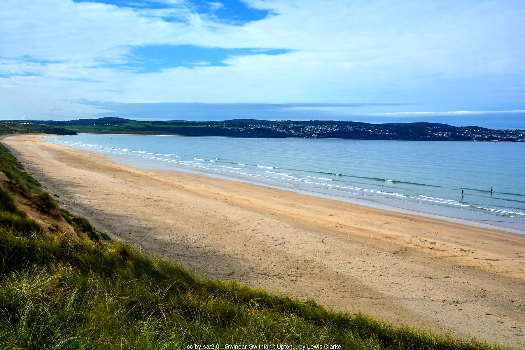
Behind the beach rise the Gwithian Towans, a substantial system of wind-blown sand dunes that forms the northern end of a much longer chain running south through Mexico Towans, Upton Towans and Hayle Towans to the Hayle estuary - collectively known simply as the Towans, and one of the most important dune landscapes in Cornwall. The dunes here fall within the Gwithian to Mexico Towans Site of Special Scientific Interest, recognised for both its geology and its biology, and Gwithian Towans itself is managed as a Local Nature Reserve. Skylarks nest in the marram grass through spring and summer, adders bask on the sunnier, more sheltered slopes, and the dune grassland supports a range of specialist plants adapted to the shifting, lime-rich sand - a habitat that is becoming increasingly scarce along the British coast as development and erosion squeeze it from both sides.
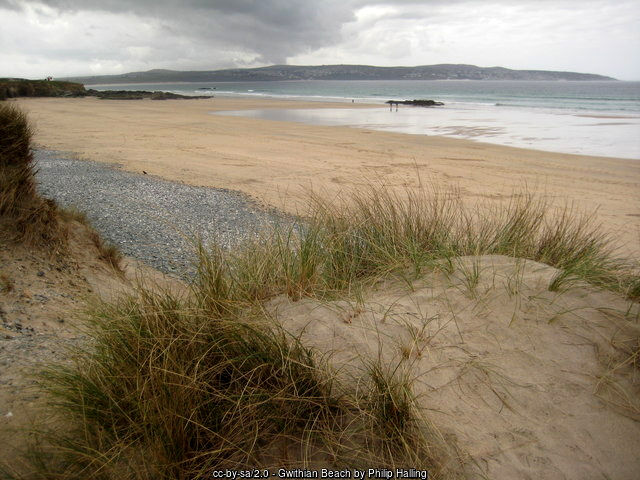
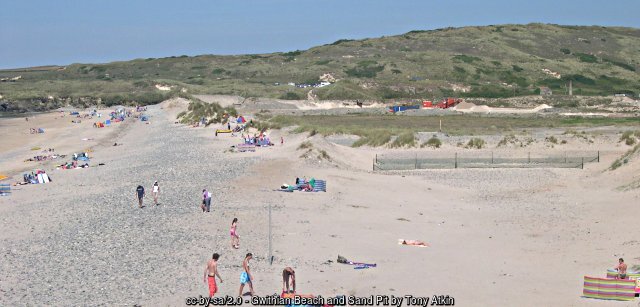
The beach itself is broad and gently shelving, opening out into a vast expanse of firm, flat sand at low tide that narrows again as the sea returns. Rock formations at the northern end toward Godrevy create sheltered pools worth exploring, including a well-known deep pool locally nicknamed the "Sheep Dips," while the cliffs here offer some shelter from the wind that makes Gwithian noticeably calmer on a blustery day than the more exposed Godrevy beach just around the point. That combination of shelter and consistent Atlantic swell has made Gwithian a longstanding favourite with surfers, windsurfers and kitesurfers as well as families, and RNLI lifeguards patrol Gwithian North Beach through the main season - daily from early May to late September, with additional cover over the Easter holidays and October weekends - with flags marking the safest stretch for swimming and surfing. As with any open Atlantic beach, care is needed around the river mouths at either end of this stretch, where currents run stronger than they appear from the sand.
The village of Gwithian itself sits just inland from the dunes, a small settlement with a history considerably longer and stranger than its modest size today suggests. The parish was historically part of the manor of Connerton, which after the Domesday Survey of 1086 - when the wider holding recorded forty ploughs, thirty villagers, twenty smallholders and thirty serfs - served as the paramount manor of the entire Hundred of Penwith. Local tradition holds that a substantial settlement, sometimes called the "city of Connor," once stood in the sandy ground between the village and the sea before being progressively engulfed by blowing sand; whatever the truth behind the legend, drifting sand was a real and persistent problem here for centuries, serious enough that the administrative functions of the manor were eventually transferred away to Penzance in 1771 as the dunes continued to encroach.
That same sand has preserved one of the most significant archaeological landscapes in Cornwall. From the late 1940s through the 1960s, the archaeologist Charles Thomas led a major, long-running excavation and survey project across the Gwithian Towans, eventually investigating more than seventy sites spanning the Mesolithic to the post-medieval period. Among the most celebrated discoveries was a Bronze Age field system, buried and protected beneath wind-blown sand, in which the actual marks left by prehistoric ploughing or ard cultivation survived intact in the old ground surface - a find significant enough to be written up in the national archaeological literature and still cited today in studies of early British farming. The same dunes also yielded an unusual sequence of Dark Age, or early medieval, structures dating from roughly the fifth to eighth centuries AD, apparently a specialised craft or seasonal workshop site rather than an ordinary settlement, with the alkaline, shell-rich sand preserving pottery and animal bone in quantities rare for Cornish sites of that period. Archaeologists still debate the precise purpose of the buildings, and the domestic settlement they presumably served has never been located - it may yet lie undiscovered somewhere within the unexcavated dunes.
The village's parish church, St Gothian's, carries its own layer of buried history. A chapel dedicated to St Gothian is recorded as having once stood out on the sandy waste nearer the coast - its former site, close to Gwithian Bridge, is still marked on Ordnance Survey maps - before it too was overwhelmed by drifting sand, prompting the construction of a permanent church further inland. Remarkably little is known for certain about Gothian: the name first appears as "Guidian" in the tenth century, was not explicitly recorded as the church's dedication until 1334, and may refer to a sixth-century Cornish nobleman mentioned in the early Life of St Samson, or possibly to a saint of Breton origin - the sources simply do not agree. The present Grade II* listed church retains a Norman font and a battlemented fifteenth-century granite tower with pinnacled quatrefoil panels, but is otherwise largely the result of a near-total rebuilding in 1865-67 by the architect Edmund Sedding, funded chiefly by the Reverend Frederick Hockin of nearby Phillack, which restored the building to something close to its original thirteenth-century cruciform plan of nave, chancel, transepts and south porch.
Mining has left its mark on this coast too, if less visibly than the archaeology. The Red River, which reaches the sea just along the coast toward Godrevy, takes its name from the reddish-brown discolouration historically caused by tin-streaming and mining effluent washed down from the Camborne and Redruth district further inland - part of the same tin and copper mining landscape that earned much of west Cornwall its UNESCO World Heritage status. Streaming for alluvial tin along valleys like this one is one of the oldest forms of mineral extraction practised in Cornwall, predating the deep hard-rock mines of the industrial era by many centuries, and the Red River's name is a small but tangible reminder of just how far downstream that industry's effects were once felt.
For visitors today, one of the simplest pleasures of Gwithian is the walk north along the coast path and dune track to Godrevy Head, a distance of about a mile that passes through St Gothian's nature reserve and opens up wide views back across St Ives Bay toward St Ives itself on the far side. Godrevy's lighthouse, seal colony and rock pools make a natural extension to a day on Gwithian's sand, and the same path continues further north along one of the most dramatic sections of the whole Cornish coast. Walking south instead leads along the beach and dune tops toward Mexico Towans, Upton Towans and eventually Hayle, tracing almost the full length of this three-mile stretch of coast in one outing, tide and time permitting. Spring and early summer tend to bring the calmest conditions and the best wildflower displays on the dunes, while the reliable Atlantic swell that draws surfers holds up well into autumn - between the scenery, the sand and the history layered beneath it, it is not hard to see why this stretch of coast was judged the best beach in the country.
Visitor Information
Parking
Car parks between the coast road and the dunes give direct access down to the beach, with further parking available at Gwithian Towans further south. Arrive early on fine summer days, as this is one of the busiest beaches in the area.
Facilities
Toilets, a beach shop and surf hire, plus the Sunset Surf café and the Jam Pot Café, a converted nineteenth-century coastguard lookout with views over the bay. RNLI lifeguards patrol Gwithian North Beach through the main season.
Disabled Access
A path leads from the main car park toward the sand, though the final approach at some access points involves a slope and steps rather than a fully level surface, so it isn't step-free throughout. Confirm current Blue Badge parking provision with Cornwall Council before you travel.
Things to Do Nearby
- Godrevy, the headland, lighthouse and seal colony about a mile north along the coast path
- Upton Towans, further south along the same dune chain, site of the former National Explosives Works
- Mexico Towans and Hayle Towans, continuing the three-mile run of dunes and sand down to the Hayle estuary
- Godrevy (National Trust) - lighthouse views, seals and coastal walking
- Cornwall Surfing Guide - surf schools, hire and conditions across the county, including St Ives Bay
Places to Stay
Frequently Asked Questions
Page last updated: 9 September 2026.